Dongshengyong geodata
Dongshengyong (Xinjiang) is a seat of a fourth-order administrative division; located in China in Asia/Urumqi (GMT+6) time zone. In our database, there are 1268 cities with bigger population. Compared to other cities in China, 89.3% of cities are located further ↓South; 70.7% of cities are located further →East and 90.4% of cities have lower elevation than Dongshengyong. Note1


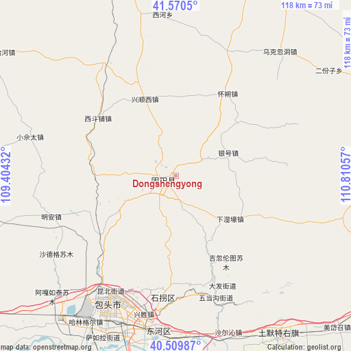
Dongshengyong GPS coordinates[2]
41° 2' 32.352" North, 110° 6' 26.784" East
| Map corner | latitude | longitude |
|---|---|---|
| Upper-left | 41.5705°, | 109.40432° |
| Center: | 41.04232°, | 110.10744° |
| Lower-right: | 40.50987°, | 110.81057° |
| Map W x H: | 117.9×117.9 km | = 73.3×73.3mi |
| max Lat: | 53.31946° ⇑10.7% North |
| Dongshengyong: | 41.04232° |
| min Lat: | ⇓89.3% South 18.22056° |
| min Long | Dongshengyong | max Long |
| 75.07348° | 110.10744° | 134.28917° |
| W 29.3%⇐ | ⇒70.7% E |
Elevation
Elevation of Dongshengyong is 1389 m = 4557 ft, and this is 904.2 m = 2967 ft above average elevation for this country.
| Max E: |
5622 m = 18445 ft | 9.6% |
| Dongshengyong | 1389 m 4557 ft | |
| Avg. | 484.8 m = 1591 ft | |
Min E: |
-3 m = -10 ft | 90.4% |
See also: China elevation on elevation.city.
Geographical zone
Dongshengyong is located in North temperate zone (between Tropic of Cancer and the Arctic Circle). Distance of this Northern Tropic circle is 1957.6 km =1216.4 mi to South.| Distance of | km | miles | from Dongshengyong |
|---|---|---|---|
| North Pole | 5443.6 | 3382.5 | to North |
| Arctic Circle | 2837.7 | 1763.3 | to North |
| Tropic Cancer | 1957.6 | 1216.4 | to South |
| Equator | 4563.5 | 2835.6 | to South |


Nearby cities:
15 places around Dongshengyong: (largest is in red/bold)
• Bailingnao
29.1 km =18.1 mi,  19°
19°
• Baliang
29.7 km =18.5 mi,  280°
280°
• Butahai
32.8 km =20.4 mi,  31°
31°
• Damiao
33.9 km =21.1 mi,  80°
80°
• Donggong Cilao
32.3 km =20.1 mi,  57°
57°
• Gongyimin
7.7 km =4.8 mi,  223°
223°
• Hongnijing
45.9 km =28.5 mi,  326°
326°
• Hujigou
22.3 km =13.9 mi,  188°
188°
• Jihuluntu Sumu
33.3 km =20.7 mi,  149°
149°
• Jinshan
4.7 km =2.9 mi,  258°
258°
• Shiguai
40.3 km =25 mi,  158°
158°
• Xiashihao
44.6 km =27.7 mi,  111°
111°
• Xidoupu
32.9 km =20.4 mi,  308°
308°
• Xinjiang
26.9 km =16.7 mi,  120°
120°
• Yinhao
18.8 km =11.7 mi, 62°
Sources, notices
• [Note1] Compared only with cities in China existing in our database
• [Src1] Map data: © OpenStreetMap contributors (CC-BY-SA)
• [Src2] Other city data from geonames.org with taken over terms of usage.
• [Src3] Geographical zone / Annual Mean Temperature by Robert A. Rohde @ Wikipedia
