Xiashihao geodata
Xiashihao (Xinjiang) is a seat of a fourth-order administrative division; located in China in Asia/Urumqi (GMT+6) time zone. In our database, there are 1268 cities with bigger population. Compared to other cities in China, 89% of cities are located further ↓South; 68.7% of cities are located further →East and 92% of cities have lower elevation than Xiashihao. Note1


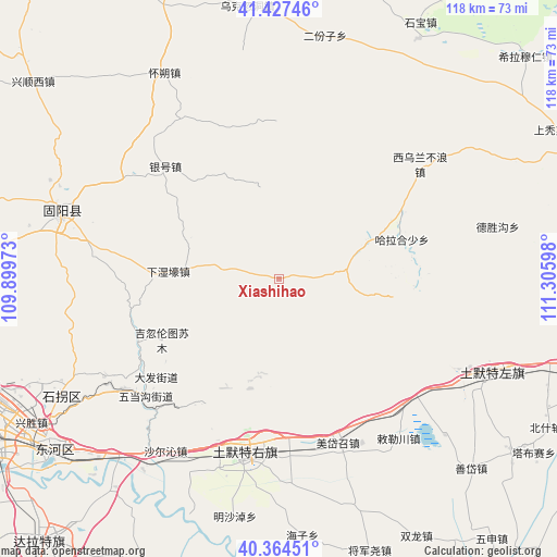
Xiashihao GPS coordinates[2]
40° 53' 53.232" North, 110° 36' 10.26" East
| Map corner | latitude | longitude |
|---|---|---|
| Upper-left | 41.42746°, | 109.89973° |
| Center: | 40.89812°, | 110.60285° |
| Lower-right: | 40.36451°, | 111.30598° |
| Map W x H: | 118.2×118.2 km | = 73.4×73.4mi |
| max Lat: | 53.31946° ⇑11% North |
| Xiashihao: | 40.89812° |
| min Lat: | ⇓89% South 18.22056° |
| min Long | Xiashihao | max Long |
| 75.07348° | 110.60285° | 134.28917° |
| W 31.3%⇐ | ⇒68.7% E |
Elevation
Elevation of Xiashihao is 1578 m = 5177 ft, and this is 1093.2 m = 3587 ft above average elevation for this country.
| Max E: |
5622 m = 18445 ft | 8% |
| Xiashihao | 1578 m 5177 ft | |
| Avg. | 484.8 m = 1591 ft | |
Min E: |
-3 m = -10 ft | 92% |
See also: China elevation on elevation.city.
Geographical zone
Xiashihao is located in North temperate zone (between Tropic of Cancer and the Arctic Circle). Distance of this Northern Tropic circle is 1941.5 km =1206.4 mi to South.| Distance of | km | miles | from Xiashihao |
|---|---|---|---|
| North Pole | 5459.6 | 3392.4 | to North |
| Arctic Circle | 2853.7 | 1773.2 | to North |
| Tropic Cancer | 1941.5 | 1206.4 | to South |
| Equator | 4547.4 | 2825.6 | to South |


Nearby cities:
15 places around Xiashihao: (largest is in red/bold)
• Damiao
23.1 km =14.4 mi,  339°
339°
• Donggong Cilao
36.5 km =22.7 mi, 336°
• Dongshengyong
44.6 km =27.7 mi,  291°
291°
• Gongyimin
48.1 km =29.9 mi,  282°
282°
• Halamendu
13.8 km =8.6 mi,  45°
45°
• Har Huxu
27.8 km =17.3 mi,  72°
72°
• Hujigou
45.3 km =28.1 mi,  262°
262°
• Jihuluntu Sumu
27.7 km =17.2 mi,  243°
243°
• Miaogou
21.2 km =13.2 mi,  98°
98°
• Salaqi
40.4 km =25.1 mi,  191°
191°
• Shiguai
34.2 km =21.3 mi,  231°
231°
• Xihong Shanzi
33.7 km =20.9 mi,  11°
11°
• Xinjiang
18.6 km =11.6 mi, 277°
• Xiwulan Bulang
39.3 km =24.4 mi, 51°
• Yinhao
35 km =21.7 mi,  314°
314°
Sources, notices
• [Note1] Compared only with cities in China existing in our database
• [Src1] Map data: © OpenStreetMap contributors (CC-BY-SA)
• [Src2] Other city data from geonames.org with taken over terms of usage.
• [Src3] Geographical zone / Annual Mean Temperature by Robert A. Rohde @ Wikipedia
