Shiguai geodata
Shiguai (Inner Mongolia) is a seat of a third-order administrative division; located in China in Asia/Shanghai (GMT+8) time zone. With population of 70,357 people, there are 612 cities with bigger population in this country. Compared to other cities in China, 88.5% of cities are located further ↓South; 70.1% of cities are located further →East and 89.7% of cities have lower elevation than Shiguai. Note1


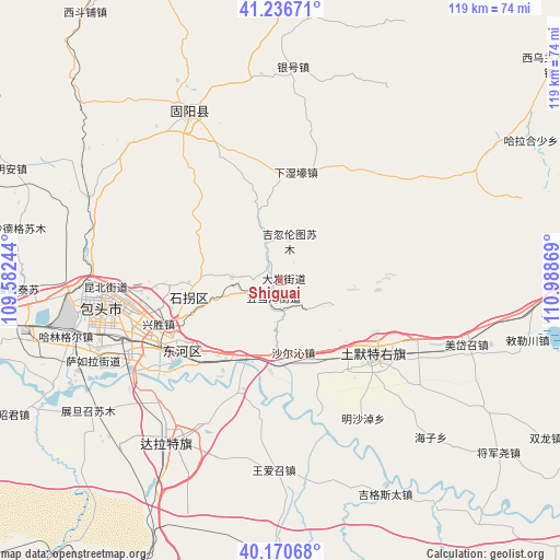
Shiguai GPS coordinates[2]
40° 42' 20.988" North, 110° 17' 8.016" East
| Map corner | latitude | longitude |
|---|---|---|
| Upper-left | 41.23671°, | 109.58244° |
| Center: | 40.70583°, | 110.28556° |
| Lower-right: | 40.17068°, | 110.98869° |
| Map W x H: | 118.5×118.5 km | = 73.6×73.6mi |
| max Lat: | 53.31946° ⇑11.5% North |
| Shiguai: | 40.70583° |
| min Lat: | ⇓88.5% South 18.22056° |
| min Long | Shiguai | max Long |
| 75.07348° | 110.28556° | 134.28917° |
| W 29.9%⇐ | ⇒70.1% E |
Elevation
Elevation of Shiguai is 1337 m = 4386 ft, and this is 852.2 m = 2796 ft above average elevation for this country.
| Max E: |
5622 m = 18445 ft | 10.3% |
| Shiguai | 1337 m 4386 ft | |
| Avg. | 484.8 m = 1591 ft | |
Min E: |
-3 m = -10 ft | 89.7% |
See also: Shiguai elevation on elevation.city.
Geographical zone
Shiguai is located in North temperate zone (between Tropic of Cancer and the Arctic Circle). Distance of this Northern Tropic circle is 1920.1 km =1193.1 mi to South.| Distance of | km | miles | from Shiguai |
|---|---|---|---|
| North Pole | 5481 | 3405.7 | to North |
| Arctic Circle | 2875.1 | 1786.5 | to North |
| Tropic Cancer | 1920.1 | 1193.1 | to South |
| Equator | 4526.1 | 2812.4 | to South |


Nearby cities:
15 places around Shiguai: (largest is in red/bold)
• Baotou
39.5 km =24.5 mi,  261°
261°
• Damiao
46.8 km =29.1 mi,  23°
23°
• Donggong Cilao
56.3 km =35 mi,  12°
12°
• Dongshengyong
40.3 km =25 mi,  338°
338°
• Gongyimin
37.8 km =23.5 mi,  327°
327°
• Halamendu
48 km =29.8 mi,  49°
49°
• Hujigou
23.8 km =14.8 mi,  309°
309°
• Jihuluntu Sumu
9 km =5.6 mi, 12°
• Jinshan
41.4 km =25.7 mi, 331°
• Miaogou
51.2 km =31.8 mi,  68°
68°
• Salaqi
26.4 km =16.4 mi,  133°
133°
• Shulinzhao
41.1 km =25.5 mi,  212°
212°
• Xiashihao
34.2 km =21.3 mi, 51°
• Xinjiang
25.1 km =15.6 mi, 19°
• Yinhao
46 km =28.6 mi,  2°
2°
Sources, notices
• [Note1] Compared only with cities in China existing in our database
• [Src1] Map data: © OpenStreetMap contributors (CC-BY-SA)
• [Src2] Other city data from geonames.org with taken over terms of usage.
• [Src3] Geographical zone / Annual Mean Temperature by Robert A. Rohde @ Wikipedia
