Chechenglu geodata
Chechenglu (Hubei) is a seat of a fourth-order administrative division; located in China in Asia/Shanghai (GMT+8) time zone. In our database, there are 1268 cities with bigger population. Compared to other cities in China, 64.5% of cities are located further ↓South; 68.1% of cities are located further →East and 61.1% of cities have lower elevation than Chechenglu. Note1


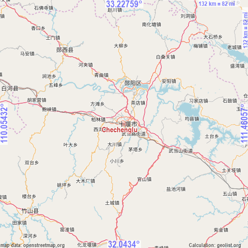
Chechenglu GPS coordinates[2]
32° 38' 14.82" North, 110° 45' 26.784" East
| Map corner | latitude | longitude |
|---|---|---|
| Upper-left | 33.22759°, | 110.05432° |
| Center: | 32.63745°, | 110.75744° |
| Lower-right: | 32.0434°, | 111.46057° |
| Map W x H: | 131.7×131.7 km | = 81.8×81.8mi |
| max Lat: | 53.31946° ⇑35.5% North |
| Chechenglu: | 32.63745° |
| min Lat: | ⇓64.5% South 18.22056° |
| min Long | Chechenglu | max Long |
| 75.07348° | 110.75744° | 134.28917° |
| W 31.9%⇐ | ⇒68.1% E |
Elevation
Elevation of Chechenglu is 272 m = 892 ft, and this is 212.8 m = 698 ft below average elevation for this country.
| Max E: |
5622 m = 18445 ft | 38.9% |
| Avg. | 484.8 m = 1591 ft | |
| Chechenglu | 272 m = 892 ft | |
Min E: |
-3 m = -10 ft | 61.1% |
See also: China elevation on elevation.city.
Geographical zone
Chechenglu is located in North temperate zone (between Tropic of Cancer and the Arctic Circle). Distance of this Northern Tropic circle is 1023 km =635.7 mi to South.| Distance of | km | miles | from Chechenglu |
|---|---|---|---|
| North Pole | 6378.1 | 3963.2 | to North |
| Arctic Circle | 3772.2 | 2343.9 | to North |
| Tropic Cancer | 1023 | 635.7 | to South |
| Equator | 3628.9 | 2254.9 | to South |


Nearby cities:
15 places around Chechenglu: (largest is in red/bold)
• Bailang
14.2 km =8.8 mi,  122°
122°
• Bailin
14 km =8.7 mi,  280°
280°
• Chadian
13.8 km =8.6 mi,  32°
32°
• Dachuan
11.6 km =7.2 mi,  206°
206°
• Eryan
2.4 km =1.5 mi,  135°
135°
• Fangtan
17.7 km =11 mi,  309°
309°
• Hanjianglu
5.8 km =3.6 mi, 34°
• Huaguo
7.8 km =4.8 mi,  274°
274°
• Huanglong
18.7 km =11.6 mi,  285°
285°
• Maota
14.4 km =8.9 mi,  155°
155°
• Qingshan
17.9 km =11.1 mi,  54°
54°
• Shiyan
2.2 km =1.4 mi,  59°
59°
• Wudanglu
6.4 km =4 mi, 143°
• Xigou
13.3 km =8.3 mi,  258°
258°
• Yuanyang
12.4 km =7.7 mi,  112°
112°
Sources, notices
• [Note1] Compared only with cities in China existing in our database
• [Src1] Map data: © OpenStreetMap contributors (CC-BY-SA)
• [Src2] Other city data from geonames.org with taken over terms of usage.
• [Src3] Geographical zone / Annual Mean Temperature by Robert A. Rohde @ Wikipedia
