Kalayemule geodata
Kalayemule (Heilongjiang) is a seat of a fourth-order administrative division; located in China in Asia/Urumqi (GMT+6) time zone. In our database, there are 1268 cities with bigger population. Compared to other cities in China, 96.4% of cities are located further ↓South; 98.7% of cities are located further →East and 85% of cities have lower elevation than Kalayemule. Note1


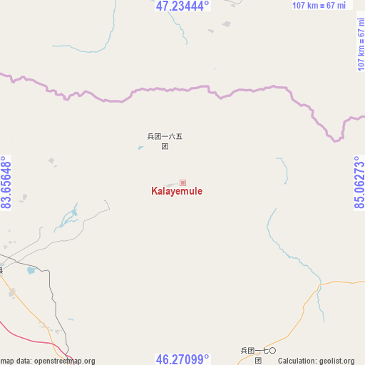
Kalayemule GPS coordinates[2]
46° 45' 17.532" North, 84° 21' 34.56" East
| Map corner | latitude | longitude |
|---|---|---|
| Upper-left | 47.23444°, | 83.65648° |
| Center: | 46.75487°, | 84.3596° |
| Lower-right: | 46.27099°, | 85.06273° |
| Map W x H: | 107.1×107.1 km | = 66.5×66.5mi |
| max Lat: | 53.31946° ⇑3.6% North |
| Kalayemule: | 46.75487° |
| min Lat: | ⇓96.4% South 18.22056° |
| min Long | Kalayemule | max Long |
| 75.07348° | 84.3596° | 134.28917° |
| W 1.3%⇐ | ⇒98.7% E |
Elevation
Elevation of Kalayemule is 982 m = 3222 ft, and this is 497.2 m = 1631 ft above average elevation for this country.
| Max E: |
5622 m = 18445 ft | 15% |
| Kalayemule | 982 m 3222 ft | |
| Avg. | 484.8 m = 1591 ft | |
Min E: |
-3 m = -10 ft | 85% |
See also: China elevation on elevation.city.
Geographical zone
Kalayemule is located in North temperate zone (between Tropic of Cancer and the Arctic Circle). Distance of this North polar circle is 2202.5 km =1368.6 mi to North.| Distance of | km | miles | from Kalayemule |
|---|---|---|---|
| North Pole | 4808.4 | 2987.8 | to North |
| Arctic Circle | 2202.5 | 1368.6 | to North |
| Tropic Cancer | 2592.7 | 1611 | to South |
| Equator | 5198.7 | 3230.3 | to South |


Nearby cities:
15 places around Kalayemule: (largest is in red/bold)
• Abudula
83.1 km =51.6 mi,  277°
277°
• Emalgolin Mongolzuxiang
28.4 km =17.6 mi,  250°
250°
• Emin
61 km =37.9 mi, 245°
• Erdaoqiao
73.3 km =45.5 mi,  236°
236°
• Hujirti Mongolzuxiang
58.5 km =36.4 mi,  223°
223°
• Jelagax
37.6 km =23.4 mi, 242°
• Jiaoqu
60.9 km =37.8 mi, 246°
• Lamazhao
55.5 km =34.5 mi,  181°
181°
• Marelesu
59.5 km =37 mi, 237°
• Qaxa
73.1 km =45.4 mi,  264°
264°
• Shanghu
42.9 km =26.7 mi, 252°
• Tiebukenwusan
83.3 km =51.8 mi,  86°
86°
• Tiechanggou
65.6 km =40.8 mi, 175°
• Wuxuete
79.9 km =49.6 mi,  202°
202°
• Yushikalasu
24.5 km =15.2 mi, 258°
Sources, notices
• [Note1] Compared only with cities in China existing in our database
• [Src1] Map data: © OpenStreetMap contributors (CC-BY-SA)
• [Src2] Other city data from geonames.org with taken over terms of usage.
• [Src3] Geographical zone / Annual Mean Temperature by Robert A. Rohde @ Wikipedia
