Shanghu geodata
Shanghu (Xinjiang) is a seat of a fourth-order administrative division; located in China in Asia/Urumqi (GMT+6) time zone. In our database, there are 1268 cities with bigger population. Compared to other cities in China, 96.1% of cities are located further ↓South; 98.8% of cities are located further →East and 78.1% of cities have lower elevation than Shanghu. Note1


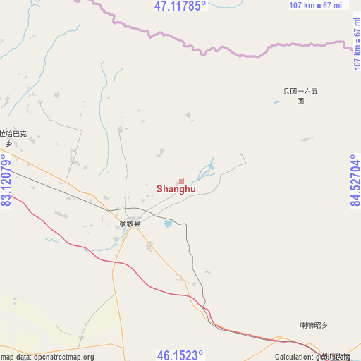
Shanghu GPS coordinates[2]
46° 38' 14.028" North, 83° 49' 26.076" East
| Map corner | latitude | longitude |
|---|---|---|
| Upper-left | 47.11785°, | 83.12079° |
| Center: | 46.63723°, | 83.82391° |
| Lower-right: | 46.1523°, | 84.52704° |
| Map W x H: | 107.4×107.4 km | = 66.7×66.7mi |
| max Lat: | 53.31946° ⇑3.9% North |
| Shanghu: | 46.63723° |
| min Lat: | ⇓96.1% South 18.22056° |
| min Long | Shanghu | max Long |
| 75.07348° | 83.82391° | 134.28917° |
| W 1.2%⇐ | ⇒98.8% E |
Elevation
Elevation of Shanghu is 618 m = 2028 ft, and this is 133.2 m = 437 ft above average elevation for this country.
| Max E: |
5622 m = 18445 ft | 21.9% |
| Shanghu | 618 m 2028 ft | |
| Avg. | 484.8 m = 1591 ft | |
Min E: |
-3 m = -10 ft | 78.1% |
See also: China elevation on elevation.city.
Geographical zone
Shanghu is located in North temperate zone (between Tropic of Cancer and the Arctic Circle). Distance of this North polar circle is 2215.6 km =1376.7 mi to North.| Distance of | km | miles | from Shanghu |
|---|---|---|---|
| North Pole | 4821.5 | 2995.9 | to North |
| Arctic Circle | 2215.6 | 1376.7 | to North |
| Tropic Cancer | 2579.7 | 1603 | to South |
| Equator | 5185.6 | 3222.2 | to South |


Nearby cities:
15 places around Shanghu: (largest is in red/bold)
• Abudula
47.8 km =29.7 mi,  299°
299°
• Akebielidou
55.5 km =34.5 mi,  212°
212°
• Emalgolin Mongolzuxiang
14.5 km =9 mi,  75°
75°
• Emil
57.2 km =35.5 mi,  271°
271°
• Emin
19.1 km =11.9 mi,  229°
229°
• Erdaoqiao
33.8 km =21 mi,  217°
217°
• Hujirti Mongolzuxiang
29.7 km =18.5 mi,  178°
178°
• Jelagax
8.4 km =5.2 mi,  118°
118°
• Jiaoqu
18.8 km =11.7 mi, 232°
• Kalayemule
42.9 km =26.7 mi,  72°
72°
• Karakabak
53.6 km =33.3 mi,  285°
285°
• Lamazhao
58.2 km =36.2 mi,  136°
136°
• Marelesu
21.1 km =13.1 mi, 205°
• Qaxa
32.5 km =20.2 mi,  280°
280°
• Yushikalasu
18.7 km =11.6 mi,  64°
64°
Sources, notices
• [Note1] Compared only with cities in China existing in our database
• [Src1] Map data: © OpenStreetMap contributors (CC-BY-SA)
• [Src2] Other city data from geonames.org with taken over terms of usage.
• [Src3] Geographical zone / Annual Mean Temperature by Robert A. Rohde @ Wikipedia
