Dahe geodata
Dahe (Hubei) is a seat of a fourth-order administrative division; located in China in Asia/Shanghai (GMT+8) time zone. In our database, there are 1268 cities with bigger population. Compared to other cities in China, 53% of cities are located further ↑North; 59.1% of cities are located further ←West and 75.7% of cities have higher elevation than Dahe. Note1


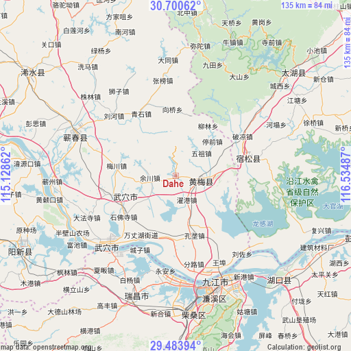
Dahe GPS coordinates[2]
30° 5' 38.94" North, 115° 49' 54.264" East
| Map corner | latitude | longitude |
|---|---|---|
| Upper-left | 30.70062°, | 115.12862° |
| Center: | 30.09415°, | 115.83174° |
| Lower-right: | 29.48394°, | 116.53487° |
| Map W x H: | 135.3×135.3 km | = 84.1×84.1mi |
| max Lat: | 53.31946° ⇑53% North |
| Dahe: | 30.09415° |
| min Lat: | ⇓47% South 18.22056° |
| min Long | Dahe | max Long |
| 75.07348° | 115.83174° | 134.28917° |
| W 59.1%⇐ | ⇒40.9% E |
Elevation
Elevation of Dahe is 35 m = 115 ft, and this is 449.8 m = 1476 ft below average elevation for this country.
| Max E: |
5622 m = 18445 ft | 75.7% |
| Avg. | 484.8 m = 1591 ft | |
| Dahe | 35 m = 115 ft | |
Min E: |
-3 m = -10 ft | 24.3% |
See also: China elevation on elevation.city.
Geographical zone
Dahe is located in North temperate zone (between Tropic of Cancer and the Arctic Circle). Distance of this Northern Tropic circle is 740.2 km =459.9 mi to South.| Distance of | km | miles | from Dahe |
|---|---|---|---|
| North Pole | 6660.9 | 4138.9 | to North |
| Arctic Circle | 4055 | 2519.7 | to North |
| Tropic Cancer | 740.2 | 459.9 | to South |
| Equator | 3346.2 | 2079.2 | to South |


Nearby cities:
15 places around Dahe: (largest is in red/bold)
• Dajin
23.7 km =14.7 mi,  243°
243°
• Dushan
20.2 km =12.6 mi,  96°
96°
• Huangmei
10.4 km =6.5 mi, 99°
• Huangmei
21.5 km =13.4 mi,  59°
59°
• Huaqiao
14.3 km =8.9 mi,  230°
230°
• Kuzhu
7.1 km =4.4 mi,  52°
52°
• Liulin
22.9 km =14.2 mi,  31°
31°
• Meichuan
23 km =14.3 mi,  279°
279°
• Shamu
13.7 km =8.5 mi,  84°
84°
• Tingqian
19.2 km =11.9 mi, 46°
• Wuzu
13.3 km =8.3 mi, 48°
• Xiaxin
20.5 km =12.7 mi,  124°
124°
• Yuchuan
9.9 km =6.2 mi,  265°
265°
• Zhanghekou
13.6 km =8.5 mi,  215°
215°
• Zhuogang
10 km =6.2 mi,  154°
154°
Sources, notices
• [Note1] Compared only with cities in China existing in our database
• [Src1] Map data: © OpenStreetMap contributors (CC-BY-SA)
• [Src2] Other city data from geonames.org with taken over terms of usage.
• [Src3] Geographical zone / Annual Mean Temperature by Robert A. Rohde @ Wikipedia
