Sizhai geodata
Sizhai (Qinghai) is a seat of a fourth-order administrative division; located in China in Asia/Shanghai (GMT+8) time zone. In our database, there are 1268 cities with bigger population. Compared to other cities in China, 78.6% of cities are located further ↓South; 93.8% of cities are located further →East and 97.1% of cities have lower elevation than Sizhai. Note1


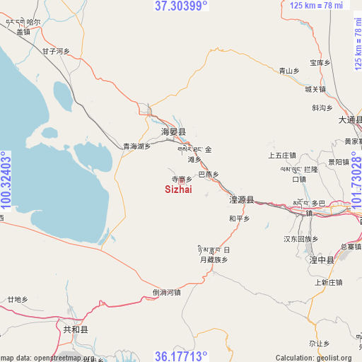
Sizhai GPS coordinates[2]
36° 44' 33.468" North, 101° 1' 37.74" East
| Map corner | latitude | longitude |
|---|---|---|
| Upper-left | 37.30399°, | 100.32403° |
| Center: | 36.74263°, | 101.02715° |
| Lower-right: | 36.17713°, | 101.73028° |
| Map W x H: | 125.3×125.3 km | = 77.9×77.9mi |
| max Lat: | 53.31946° ⇑21.4% North |
| Sizhai: | 36.74263° |
| min Lat: | ⇓78.6% South 18.22056° |
| min Long | Sizhai | max Long |
| 75.07348° | 101.02715° | 134.28917° |
| W 6.2%⇐ | ⇒93.8% E |
Elevation
Elevation of Sizhai is 3098 m = 10164 ft, and this is 2613.2 m = 8573 ft above average elevation for this country.
| Max E: |
5622 m = 18445 ft | 2.9% |
| Sizhai | 3098 m 10164 ft | |
| Avg. | 484.8 m = 1591 ft | |
Min E: |
-3 m = -10 ft | 97.1% |
See also: China elevation on elevation.city.
Geographical zone
Sizhai is located in North temperate zone (between Tropic of Cancer and the Arctic Circle). Distance of this Northern Tropic circle is 1479.5 km =919.3 mi to South.| Distance of | km | miles | from Sizhai |
|---|---|---|---|
| North Pole | 5921.7 | 3679.6 | to North |
| Arctic Circle | 3315.8 | 2060.3 | to North |
| Tropic Cancer | 1479.5 | 919.3 | to South |
| Equator | 4085.4 | 2538.5 | to South |


Nearby cities:
15 places around Sizhai: (largest is in red/bold)
• Bayan
9.7 km =6 mi,  74°
74°
• Beihe
39.5 km =24.5 mi,  115°
115°
• Dahua
17.4 km =10.8 mi,  108°
108°
• Daotanghe
38.6 km =24 mi,  188°
188°
• Dongxia
27.5 km =17.1 mi,  104°
104°
• Duoba
46.1 km =28.6 mi, 101°
• Heping
22.4 km =13.9 mi, 122°
• Huangyuan Chengguanzhen
22.6 km =14 mi, 105°
• Lanlongkou
40 km =24.9 mi,  85°
85°
• Qinghaihu
21.2 km =13.2 mi,  300°
300°
• Riyue
25.4 km =15.8 mi,  153°
153°
• Sanjiaocheng
16.7 km =10.4 mi,  351°
351°
• Shangwuzhuang
37.2 km =23.1 mi, 70°
• Shenzhong
14.4 km =8.9 mi, 98°
• Tawan
9.5 km =5.9 mi,  128°
128°
Sources, notices
• [Note1] Compared only with cities in China existing in our database
• [Src1] Map data: © OpenStreetMap contributors (CC-BY-SA)
• [Src2] Other city data from geonames.org with taken over terms of usage.
• [Src3] Geographical zone / Annual Mean Temperature by Robert A. Rohde @ Wikipedia
