Alatan'molezhen geodata
Alatan'molezhen (Inner Mongolia) is a seat of a third-order administrative division; located in China in Asia/Shanghai (GMT+8) time zone. In our database, there are 1268 cities with bigger population. Compared to other cities in China, 99% of cities are located further ↓South; 65% of cities are located further ←West and 76.3% of cities have lower elevation than Alatan'molezhen. Note1
Administrative division(s):
- Level 1: Inner Mongolia
- Level 2: Hulunbuir Region
- Level 3: New Barag Right Banner


Alatan'molezhen GPS coordinates[2]
48° 39' 51.336" North, 116° 48' 40.392" East
| Map corner | latitude | longitude |
|---|---|---|
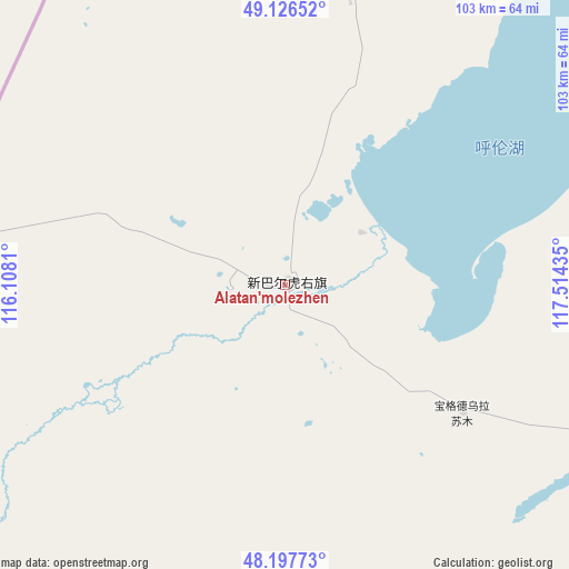
| Upper-left | 49.12652°, | 116.1081° |
| Center: | 48.66426°, | 116.81122° |
| Lower-right: | 48.19773°, | 117.51435° |
| Map W x H: | 103.3×103.3 km | = 64.2×64.2mi |
| max Lat: | 53.31946° ⇑1% North |
| Alatan'molezhen: | 48.66426° |
| min Lat: | ⇓99% South 18.22056° |
| min Long | Alatan'molezhen | max Long |
| 75.07348° | 116.81122° | 134.28917° |
| W 65%⇐ | ⇒35% E |
Elevation
Elevation of Alatan'molezhen is 554 m = 1818 ft, and this is 69.2 m = 227 ft above average elevation for this country.
| Max E: |
5622 m = 18445 ft | 23.7% |
| Alatan'molezhen | 554 m 1818 ft | |
| Avg. | 484.8 m = 1591 ft | |
Min E: |
-3 m = -10 ft | 76.3% |
See also: China elevation on elevation.city.
Geographical zone
Alatan'molezhen is located in North temperate zone (between Tropic of Cancer and the Arctic Circle). Distance of this North polar circle is 1990.2 km =1236.7 mi to North.| Distance of | km | miles | from Alatan'molezhen |
|---|---|---|---|
| North Pole | 4596.1 | 2855.9 | to North |
| Arctic Circle | 1990.2 | 1236.7 | to North |
| Tropic Cancer | 2805 | 1742.9 | to South |
| Equator | 5411 | 3362.2 | to South |


Nearby cities:
15 places around Alatan'molezhen: (largest is in red/bold)
• Adun Chulu
52.3 km =32.5 mi,  241°
241°
• Amgalang
112.3 km =69.8 mi,  114°
114°
• Amu Gulang Baolige
103.6 km =64.4 mi, 109°
• A’ershan
9.4 km =5.8 mi,  63°
63°
• Baogede Wula
39.6 km =24.6 mi,  125°
125°
• Bei’er
86 km =53.4 mi,  145°
145°
• Dalai
52.7 km =32.7 mi,  12°
12°
• Dalaidong
82.6 km =51.3 mi,  15°
15°
• E’erdun Wula
29.4 km =18.3 mi,  353°
353°
• Hangwula
33.7 km =20.9 mi,  229°
229°
• Hulun
10 km =6.2 mi,  99°
99°
• Jalai Nur
108.7 km =67.5 mi,  36°
36°
• Jibu Hulangtu
77.2 km =48 mi, 64°
• Ke’erlun
89.7 km =55.7 mi, 231°
• Saihan Tala
58.8 km =36.5 mi, 234°
Sources, notices
• [Note1] Compared only with cities in China existing in our database
• [Src1] Map data: © OpenStreetMap contributors (CC-BY-SA)
• [Src2] Other city data from geonames.org with taken over terms of usage.
• [Src3] Geographical zone / Annual Mean Temperature by Robert A. Rohde @ Wikipedia
