Huoche Xizhan geodata
Huoche Xizhan (Xinjiang) is a seat of a third-order administrative division; located in China in Asia/Urumqi (GMT+6) time zone. In our database, there are 1268 cities with bigger population. Compared to other cities in China, 92.6% of cities are located further ↓South; 98.1% of cities are located further →East and 81% of cities have lower elevation than Huoche Xizhan. Note1


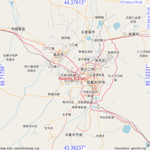
Huoche Xizhan GPS coordinates[2]
43° 52' 17.076" North, 87° 25' 12.648" East
| Map corner | latitude | longitude |
|---|---|---|
| Upper-left | 44.37613°, | 86.71706° |
| Center: | 43.87141°, | 87.42018° |
| Lower-right: | 43.36237°, | 88.12331° |
| Map W x H: | 112.7×112.7 km | = 70×70mi |
| max Lat: | 53.31946° ⇑7.4% North |
| Huoche Xizhan: | 43.87141° |
| min Lat: | ⇓92.6% South 18.22056° |
| min Long | Huoche Xizhan | max Long |
| 75.07348° | 87.42018° | 134.28917° |
| W 1.9%⇐ | ⇒98.1% E |
Elevation
Elevation of Huoche Xizhan is 744 m = 2441 ft, and this is 259.2 m = 850 ft above average elevation for this country.
| Max E: |
5622 m = 18445 ft | 19% |
| Huoche Xizhan | 744 m 2441 ft | |
| Avg. | 484.8 m = 1591 ft | |
Min E: |
-3 m = -10 ft | 81% |
See also: China elevation on elevation.city.
Geographical zone
Huoche Xizhan is located in North temperate zone (between Tropic of Cancer and the Arctic Circle). Distance of this Northern Tropic circle is 2272.1 km =1411.8 mi to South.| Distance of | km | miles | from Huoche Xizhan |
|---|---|---|---|
| North Pole | 5129 | 3187 | to North |
| Arctic Circle | 2523.1 | 1567.8 | to North |
| Tropic Cancer | 2272.1 | 1411.8 | to South |
| Equator | 4878 | 3031 | to South |


Nearby cities:
15 places around Huoche Xizhan: (largest is in red/bold)
• Anningqu
15.4 km =9.6 mi,  36°
36°
• Beijinglu
13.2 km =8.2 mi,  108°
108°
• Bingchao
24.6 km =15.3 mi,  351°
351°
• Changji
17.8 km =11.1 mi,  328°
328°
• Changshanzi
28.6 km =17.8 mi,  32°
32°
• Daxiqu
28.6 km =17.8 mi,  336°
336°
• Diwopu
5.2 km =3.2 mi,  75°
75°
• Ergong
12 km =7.5 mi,  101°
101°
• Erliugong
28.4 km =17.6 mi,  315°
315°
• Gumudi
22.3 km =13.9 mi,  65°
65°
• Liugong
22.8 km =14.2 mi,  356°
356°
• Shuimogou
18.1 km =11.2 mi, 105°
• Xingfulu
20 km =12.4 mi,  119°
119°
• Yangzi Jianglu
17.4 km =10.8 mi,  128°
128°
• Ürümqi
16.4 km =10.2 mi, 118°
Sources, notices
• [Note1] Compared only with cities in China existing in our database
• [Src1] Map data: © OpenStreetMap contributors (CC-BY-SA)
• [Src2] Other city data from geonames.org with taken over terms of usage.
• [Src3] Geographical zone / Annual Mean Temperature by Robert A. Rohde @ Wikipedia
