Hujirti geodata
Hujirti (Xinjiang) is a seat of a fourth-order administrative division; located in China in Asia/Urumqi (GMT+6) time zone. In our database, there are 1268 cities with bigger population. Compared to other cities in China, 92.1% of cities are located further ↓South; 99.2% of cities are located further →East and 87.8% of cities have lower elevation than Hujirti. Note1


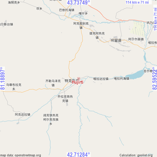
Hujirti GPS coordinates[2]
43° 13' 38.352" North, 81° 53' 31.524" East
| Map corner | latitude | longitude |
|---|---|---|
| Upper-left | 43.73749°, | 81.18897° |
| Center: | 43.22732°, | 81.89209° |
| Lower-right: | 42.71284°, | 82.59522° |
| Map W x H: | 113.9×113.9 km | = 70.8×70.8mi |
| max Lat: | 53.31946° ⇑7.9% North |
| Hujirti: | 43.22732° |
| min Lat: | ⇓92.1% South 18.22056° |
| min Long | Hujirti | max Long |
| 75.07348° | 81.89209° | 134.28917° |
| W 0.8%⇐ | ⇒99.2% E |
Elevation
Elevation of Hujirti is 1172 m = 3845 ft, and this is 687.2 m = 2255 ft above average elevation for this country.
| Max E: |
5622 m = 18445 ft | 12.2% |
| Hujirti | 1172 m 3845 ft | |
| Avg. | 484.8 m = 1591 ft | |
Min E: |
-3 m = -10 ft | 87.8% |
See also: China elevation on elevation.city.
Geographical zone
Hujirti is located in North temperate zone (between Tropic of Cancer and the Arctic Circle). Distance of this Northern Tropic circle is 2200.5 km =1367.3 mi to South.| Distance of | km | miles | from Hujirti |
|---|---|---|---|
| North Pole | 5200.6 | 3231.5 | to North |
| Arctic Circle | 2594.7 | 1612.3 | to North |
| Tropic Cancer | 2200.5 | 1367.3 | to South |
| Equator | 4806.4 | 2986.6 | to South |


Nearby cities:
15 places around Hujirti: (largest is in red/bold)
• Agarsin
50.7 km =31.5 mi,  55°
55°
• Akdala
49.3 km =30.6 mi,  237°
237°
• Dongmazar
67.2 km =41.8 mi,  357°
357°
• Jagistay
66.6 km =41.4 mi,  305°
305°
• Kan
56.7 km =35.2 mi,  330°
330°
• Karasu
73 km =45.4 mi,  19°
19°
• Kax
46 km =28.6 mi, 357°
• Muhur
60.1 km =37.3 mi,  92°
92°
• Onyar
69.8 km =43.4 mi,  352°
352°
• Tekes
4.4 km =2.7 mi,  254°
254°
• Tikerik
35 km =21.7 mi, 23°
• Tokkuztara
33.8 km =21 mi,  37°
37°
• Yengitam
60.7 km =37.7 mi,  341°
341°
• Yuqunweng
75.2 km =46.7 mi, 343°
• Zhaosu
67.2 km =41.8 mi,  260°
260°
Sources, notices
• [Note1] Compared only with cities in China existing in our database
• [Src1] Map data: © OpenStreetMap contributors (CC-BY-SA)
• [Src2] Other city data from geonames.org with taken over terms of usage.
• [Src3] Geographical zone / Annual Mean Temperature by Robert A. Rohde @ Wikipedia
