Yuqunweng geodata
Yuqunweng (Xinjiang) is a seat of a fourth-order administrative division; located in China in Asia/Urumqi (GMT+6) time zone. In our database, there are 1268 cities with bigger population. Compared to other cities in China, 92.6% of cities are located further ↓South; 99.2% of cities are located further →East and 80.3% of cities have lower elevation than Yuqunweng. Note1


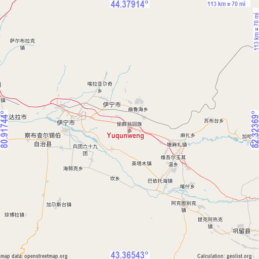
Yuqunweng GPS coordinates[2]
43° 52' 27.984" North, 81° 37' 14.016" East
| Map corner | latitude | longitude |
|---|---|---|
| Upper-left | 44.37914°, | 80.91744° |
| Center: | 43.87444°, | 81.62056° |
| Lower-right: | 43.36543°, | 82.32369° |
| Map W x H: | 112.7×112.7 km | = 70×70mi |
| max Lat: | 53.31946° ⇑7.4% North |
| Yuqunweng: | 43.87444° |
| min Lat: | ⇓92.6% South 18.22056° |
| min Long | Yuqunweng | max Long |
| 75.07348° | 81.62056° | 134.28917° |
| W 0.8%⇐ | ⇒99.2% E |
Elevation
Elevation of Yuqunweng is 709 m = 2326 ft, and this is 224.2 m = 736 ft above average elevation for this country.
| Max E: |
5622 m = 18445 ft | 19.7% |
| Yuqunweng | 709 m 2326 ft | |
| Avg. | 484.8 m = 1591 ft | |
Min E: |
-3 m = -10 ft | 80.3% |
See also: China elevation on elevation.city.
Geographical zone
Yuqunweng is located in North temperate zone (between Tropic of Cancer and the Arctic Circle). Distance of this Northern Tropic circle is 2272.5 km =1412.1 mi to South.| Distance of | km | miles | from Yuqunweng |
|---|---|---|---|
| North Pole | 5128.7 | 3186.8 | to North |
| Arctic Circle | 2522.8 | 1567.6 | to North |
| Tropic Cancer | 2272.5 | 1412.1 | to South |
| Equator | 4878.4 | 3031.3 | to South |


Nearby cities:
15 places around Yuqunweng: (largest is in red/bold)
• Ailan Mubage
23.4 km =14.5 mi,  279°
279°
• Dadamtu
27.2 km =16.9 mi,  295°
295°
• Dongmazar
19.1 km =11.9 mi,  104°
104°
• Kan
23.6 km =14.7 mi,  195°
195°
• Kax
32.8 km =20.4 mi,  142°
142°
• Onyar
13.3 km =8.3 mi, 101°
• Qapqal
43.5 km =27 mi,  259°
259°
• Sadikyüzi
7.9 km =4.9 mi,  319°
319°
• Suptay
41.2 km =25.6 mi,  79°
79°
• Taxkowrük
25.3 km =15.7 mi,  274°
274°
• Turpanyüzi
17.9 km =11.1 mi, 320°
• Yengitam
14.6 km =9.1 mi,  168°
168°
• Yengiyar
38.7 km =24 mi,  285°
285°
• Yili
21.9 km =13.6 mi, 277°
• Yining
14.1 km =8.8 mi, 324°
Sources, notices
• [Note1] Compared only with cities in China existing in our database
• [Src1] Map data: © OpenStreetMap contributors (CC-BY-SA)
• [Src2] Other city data from geonames.org with taken over terms of usage.
• [Src3] Geographical zone / Annual Mean Temperature by Robert A. Rohde @ Wikipedia
