Nilka geodata
Nilka (Xinjiang) is a seat of a third-order administrative division; located in China in Asia/Urumqi (GMT+6) time zone. In our database, there are 1268 cities with bigger population. Compared to other cities in China, 92.5% of cities are located further ↓South; 99.1% of cities are located further →East and 86.6% of cities have lower elevation than Nilka. Note1


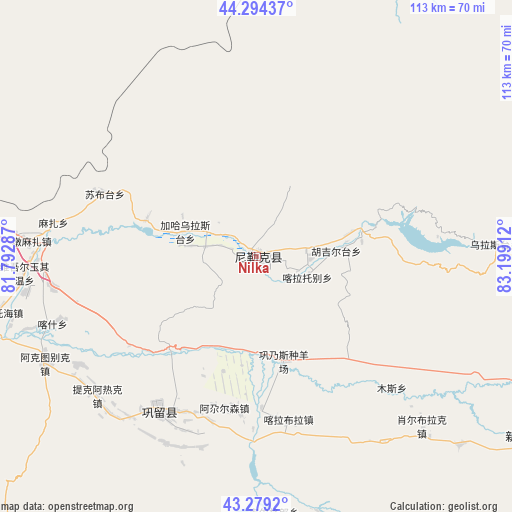
Nilka GPS coordinates[2]
43° 47' 20.184" North, 82° 29' 45.564" East
| Map corner | latitude | longitude |
|---|---|---|
| Upper-left | 44.29437°, | 81.79287° |
| Center: | 43.78894°, | 82.49599° |
| Lower-right: | 43.2792°, | 83.19912° |
| Map W x H: | 112.9×112.9 km | = 70.2×70.2mi |
| max Lat: | 53.31946° ⇑7.5% North |
| Nilka: | 43.78894° |
| min Lat: | ⇓92.5% South 18.22056° |
| min Long | Nilka | max Long |
| 75.07348° | 82.49599° | 134.28917° |
| W 0.9%⇐ | ⇒99.1% E |
Elevation
Elevation of Nilka is 1091 m = 3579 ft, and this is 606.2 m = 1989 ft above average elevation for this country.
| Max E: |
5622 m = 18445 ft | 13.4% |
| Nilka | 1091 m 3579 ft | |
| Avg. | 484.8 m = 1591 ft | |
Min E: |
-3 m = -10 ft | 86.6% |
See also: China elevation on elevation.city.
Geographical zone
Nilka is located in North temperate zone (between Tropic of Cancer and the Arctic Circle). Distance of this Northern Tropic circle is 2263 km =1406.2 mi to South.| Distance of | km | miles | from Nilka |
|---|---|---|---|
| North Pole | 5138.2 | 3192.7 | to North |
| Arctic Circle | 2532.3 | 1573.5 | to North |
| Tropic Cancer | 2263 | 1406.2 | to South |
| Equator | 4868.9 | 3025.4 | to South |


Nearby cities:
15 places around Nilka: (largest is in red/bold)
• Agarsin
34.3 km =21.3 mi,  192°
192°
• Dongmazar
52 km =32.3 mi,  275°
275°
• Karasu
25.4 km =15.8 mi, 284°
• Karatobe
12 km =7.5 mi,  111°
111°
• Kax
52.9 km =32.9 mi,  251°
251°
• Muhur
66.4 km =41.3 mi,  170°
170°
• Onyar
57.6 km =35.8 mi, 276°
• Suptay
34.2 km =21.3 mi,  299°
299°
• Taldi
61.3 km =38.1 mi,  132°
132°
• Tikerik
46.2 km =28.7 mi,  229°
229°
• Tokkuztara
45.4 km =28.2 mi,  217°
217°
• Xorbulak
53 km =32.9 mi,  135°
135°
• Yengitam
67.5 km =41.9 mi,  265°
265°
• Yuqunweng
70.9 km =44.1 mi, 277°
• Zekti
68.9 km =42.8 mi, 114°
Sources, notices
• [Note1] Compared only with cities in China existing in our database
• [Src1] Map data: © OpenStreetMap contributors (CC-BY-SA)
• [Src2] Other city data from geonames.org with taken over terms of usage.
• [Src3] Geographical zone / Annual Mean Temperature by Robert A. Rohde @ Wikipedia
