Karatobe geodata
Karatobe (Xinjiang) is a seat of a fourth-order administrative division; located in China in Asia/Urumqi (GMT+6) time zone. In our database, there are 1268 cities with bigger population. Compared to other cities in China, 92.5% of cities are located further ↓South; 99% of cities are located further →East and 87.5% of cities have lower elevation than Karatobe. Note1


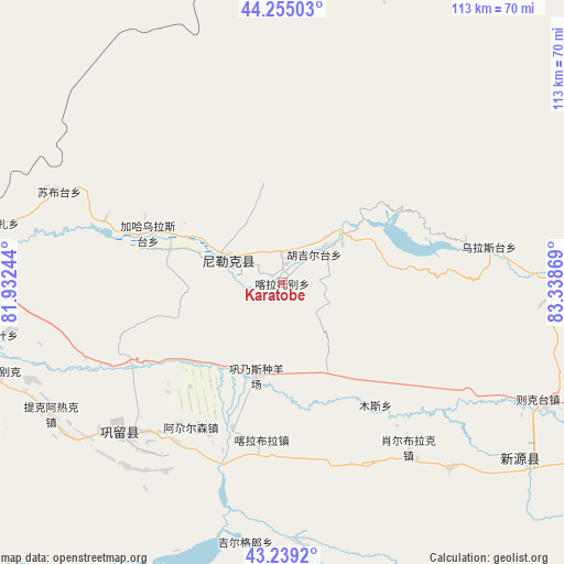
Karatobe GPS coordinates[2]
43° 44' 57.372" North, 82° 38' 8.016" East
| Map corner | latitude | longitude |
|---|---|---|
| Upper-left | 44.25503°, | 81.93244° |
| Center: | 43.74927°, | 82.63556° |
| Lower-right: | 43.2392°, | 83.33869° |
| Map W x H: | 112.9×112.9 km | = 70.2×70.2mi |
| max Lat: | 53.31946° ⇑7.5% North |
| Karatobe: | 43.74927° |
| min Lat: | ⇓92.5% South 18.22056° |
| min Long | Karatobe | max Long |
| 75.07348° | 82.63556° | 134.28917° |
| W 1%⇐ | ⇒99% E |
Elevation
Elevation of Karatobe is 1152 m = 3780 ft, and this is 667.2 m = 2189 ft above average elevation for this country.
| Max E: |
5622 m = 18445 ft | 12.5% |
| Karatobe | 1152 m 3780 ft | |
| Avg. | 484.8 m = 1591 ft | |
Min E: |
-3 m = -10 ft | 87.5% |
See also: China elevation on elevation.city.
Geographical zone
Karatobe is located in North temperate zone (between Tropic of Cancer and the Arctic Circle). Distance of this Northern Tropic circle is 2258.5 km =1403.4 mi to South.| Distance of | km | miles | from Karatobe |
|---|---|---|---|
| North Pole | 5142.6 | 3195.5 | to North |
| Arctic Circle | 2536.7 | 1576.2 | to North |
| Tropic Cancer | 2258.5 | 1403.4 | to South |
| Equator | 4864.5 | 3022.7 | to South |


Nearby cities:
15 places around Karatobe: (largest is in red/bold)
• Agarsin
34.5 km =21.4 mi,  212°
212°
• Dongmazar
63.7 km =39.6 mi,  278°
278°
• Karasu
37.4 km =23.2 mi,  286°
286°
• Kax
62.7 km =39 mi,  258°
258°
• Muhur
61.1 km =38 mi,  180°
180°
• Nilka
12 km =7.5 mi, 291°
• Onyar
69.3 km =43.1 mi, 279°
• Suptay
46.1 km =28.6 mi,  297°
297°
• Taldi
50.3 km =31.3 mi,  137°
137°
• Tikerik
52.9 km =32.9 mi,  240°
240°
• Tokkuztara
50.2 km =31.2 mi,  231°
231°
• Türgen
71.4 km =44.4 mi,  111°
111°
• Xinyuan
61.1 km =38 mi,  125°
125°
• Xorbulak
42.3 km =26.3 mi, 141°
• Zekti
56.9 km =35.4 mi, 114°
Sources, notices
• [Note1] Compared only with cities in China existing in our database
• [Src1] Map data: © OpenStreetMap contributors (CC-BY-SA)
• [Src2] Other city data from geonames.org with taken over terms of usage.
• [Src3] Geographical zone / Annual Mean Temperature by Robert A. Rohde @ Wikipedia
