Zhaowanzhuang geodata
Zhaowanzhuang (Jiangsu) is a seat of a fourth-order administrative division; located in China in Asia/Shanghai (GMT+8) time zone. In our database, there are 1268 cities with bigger population. Compared to other cities in China, 65% of cities are located further ↓South; 83% of cities are located further ←West and 99.7% of cities have higher elevation than Zhaowanzhuang. Note1


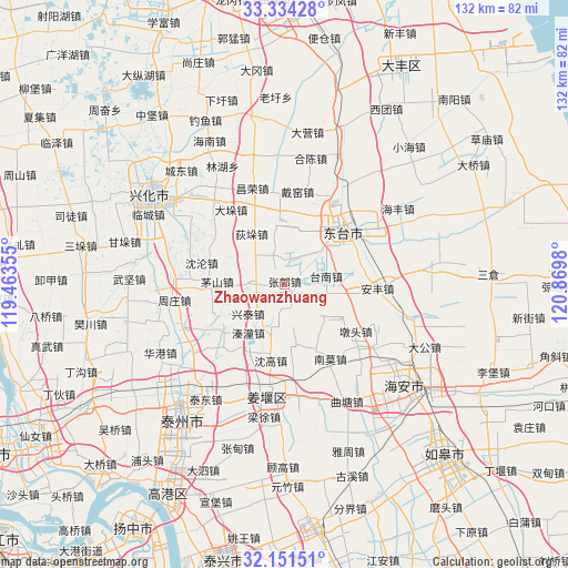
Zhaowanzhuang GPS coordinates[2]
32° 44' 41.496" North, 120° 10' 0.012" East
| Map corner | latitude | longitude |
|---|---|---|
| Upper-left | 33.33428°, | 119.46355° |
| Center: | 32.74486°, | 120.16667° |
| Lower-right: | 32.15151°, | 120.8698° |
| Map W x H: | 131.5×131.5 km | = 81.7×81.7mi |
| max Lat: | 53.31946° ⇑35% North |
| Zhaowanzhuang: | 32.74486° |
| min Lat: | ⇓65% South 18.22056° |
| min Long | Zhaowanzhuang | max Long |
| 75.07348° | 120.16667° | 134.28917° |
| W 83%⇐ | ⇒17% E |
Elevation
Elevation of Zhaowanzhuang is 1 m = 3 ft, and this is 483.8 m = 1587 ft below average elevation for this country.
| Max E: |
5622 m = 18445 ft | 99.7% |
| Avg. | 484.8 m = 1591 ft | |
| Zhaowanzhuang | 1 m = 3 ft | |
Min E: |
-3 m = -10 ft | 0.3% |
See also: China elevation on elevation.city.
Geographical zone
Zhaowanzhuang is located in North temperate zone (between Tropic of Cancer and the Arctic Circle). Distance of this Northern Tropic circle is 1035 km =643.1 mi to South.| Distance of | km | miles | from Zhaowanzhuang |
|---|---|---|---|
| North Pole | 6366.2 | 3955.8 | to North |
| Arctic Circle | 3760.3 | 2336.5 | to North |
| Tropic Cancer | 1035 | 643.1 | to South |
| Equator | 3640.9 | 2262.3 | to South |


Nearby cities:
15 places around Zhaowanzhuang: (largest is in red/bold)
• Baidian
11.8 km =7.3 mi,  134°
134°
• Dainan
4.7 km =2.9 mi,  228°
228°
• Diduo
14.9 km =9.3 mi,  325°
325°
• Dongtai
17.9 km =11.1 mi,  48°
48°
• Guangshan
7.8 km =4.8 mi,  31°
31°
• Hougang
10.4 km =6.5 mi, 128°
• Maoshan
15 km =9.3 mi,  268°
268°
• Qintong
12.7 km =7.9 mi,  213°
213°
• Shengao
17.9 km =11.1 mi,  190°
190°
• Shiyan
2.9 km =1.8 mi,  148°
148°
• Tainan
9.8 km =6.1 mi,  78°
78°
• Taozhuang
13.8 km =8.6 mi,  349°
349°
• Wulie
14.5 km =9 mi, 29°
• Xingtai
10.8 km =6.7 mi, 232°
• Zhendong
10.6 km =6.6 mi, 186°
Sources, notices
• [Note1] Compared only with cities in China existing in our database
• [Src1] Map data: © OpenStreetMap contributors (CC-BY-SA)
• [Src2] Other city data from geonames.org with taken over terms of usage.
• [Src3] Geographical zone / Annual Mean Temperature by Robert A. Rohde @ Wikipedia
