Songzhuang geodata
Songzhuang (Jiangsu) is a seat of a fourth-order administrative division; located in China in Asia/Shanghai (GMT+8) time zone. In our database, there are 1268 cities with bigger population. Compared to other cities in China, 74.2% of cities are located further ↓South; 76.7% of cities are located further ←West and 99.4% of cities have higher elevation than Songzhuang. Note1


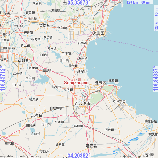
Songzhuang GPS coordinates[2]
34° 46' 59.952" North, 119° 8' 24.864" East
| Map corner | latitude | longitude |
|---|---|---|
| Upper-left | 35.35878°, | 118.43712° |
| Center: | 34.78332°, | 119.14024° |
| Lower-right: | 34.20382°, | 119.84337° |
| Map W x H: | 128.4×128.4 km | = 79.8×79.8mi |
| max Lat: | 53.31946° ⇑25.8% North |
| Songzhuang: | 34.78332° |
| min Lat: | ⇓74.2% South 18.22056° |
| min Long | Songzhuang | max Long |
| 75.07348° | 119.14024° | 134.28917° |
| W 76.7%⇐ | ⇒23.3% E |
Elevation
Elevation of Songzhuang is 2 m = 7 ft, and this is 482.8 m = 1584 ft below average elevation for this country.
| Max E: |
5622 m = 18445 ft | 99.4% |
| Avg. | 484.8 m = 1591 ft | |
| Songzhuang | 2 m = 7 ft | |
Min E: |
-3 m = -10 ft | 0.6% |
See also: China elevation on elevation.city.
Geographical zone
Songzhuang is located in North temperate zone (between Tropic of Cancer and the Arctic Circle). Distance of this Northern Tropic circle is 1261.6 km =783.9 mi to South.| Distance of | km | miles | from Songzhuang |
|---|---|---|---|
| North Pole | 6139.5 | 3814.9 | to North |
| Arctic Circle | 3533.6 | 2195.7 | to North |
| Tropic Cancer | 1261.6 | 783.9 | to South |
| Equator | 3867.5 | 2403.2 | to South |


Nearby cities:
15 places around Songzhuang: (largest is in red/bold)
• Chaoyang
18.3 km =11.4 mi,  128°
128°
• Dunshang
12.4 km =7.7 mi,  228°
228°
• Gaogongdao
32.1 km =19.9 mi,  107°
107°
• Haitou
16.9 km =10.5 mi,  9°
9°
• Haizhou
22.4 km =13.9 mi,  182°
182°
• Huaguoshan
17.9 km =11.1 mi,  151°
151°
• Jinping
29.7 km =18.5 mi, 184°
• Lianyun
28.2 km =17.5 mi,  101°
101°
• Lianyungang
21.7 km =13.5 mi,  161°
161°
• Luoyang
8.6 km =5.3 mi,  200°
200°
• Nancheng
25.8 km =16 mi, 162°
• Qingkou
7.8 km =4.8 mi,  338°
338°
• Xinpu
20.5 km =12.7 mi, 175°
• Yunshan
22.7 km =14.1 mi, 114°
• Zhongyun
28.6 km =17.8 mi,  121°
121°
Sources, notices
• [Note1] Compared only with cities in China existing in our database
• [Src1] Map data: © OpenStreetMap contributors (CC-BY-SA)
• [Src2] Other city data from geonames.org with taken over terms of usage.
• [Src3] Geographical zone / Annual Mean Temperature by Robert A. Rohde @ Wikipedia
