Xinhang geodata
Xinhang (Anhui) is a seat of a fourth-order administrative division; located in China in Asia/Shanghai (GMT+8) time zone. In our database, there are 1268 cities with bigger population. Compared to other cities in China, 55.3% of cities are located further ↓South; 79.2% of cities are located further ←West and 65.2% of cities have higher elevation than Xinhang. Note1


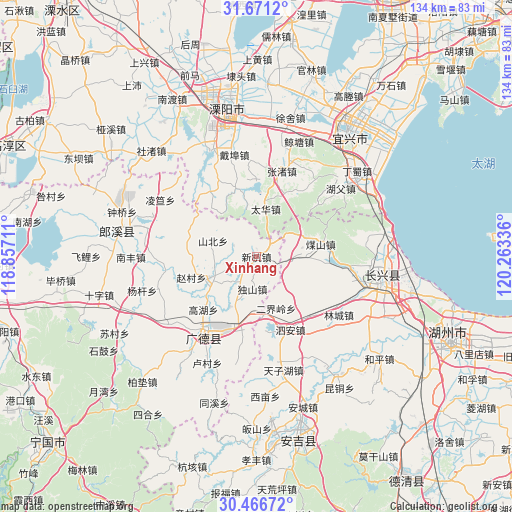
Xinhang GPS coordinates[2]
31° 4' 15.132" North, 119° 33' 36.828" East
| Map corner | latitude | longitude |
|---|---|---|
| Upper-left | 31.6712°, | 118.85711° |
| Center: | 31.07087°, | 119.56023° |
| Lower-right: | 30.46672°, | 120.26336° |
| Map W x H: | 133.9×133.9 km | = 83.2×83.2mi |
| max Lat: | 53.31946° ⇑44.7% North |
| Xinhang: | 31.07087° |
| min Lat: | ⇓55.3% South 18.22056° |
| min Long | Xinhang | max Long |
| 75.07348° | 119.56023° | 134.28917° |
| W 79.2%⇐ | ⇒20.8% E |
Elevation
Elevation of Xinhang is 72 m = 236 ft, and this is 412.8 m = 1354 ft below average elevation for this country.
| Max E: |
5622 m = 18445 ft | 65.2% |
| Avg. | 484.8 m = 1591 ft | |
| Xinhang | 72 m = 236 ft | |
Min E: |
-3 m = -10 ft | 34.8% |
See also: China elevation on elevation.city.
Geographical zone
Xinhang is located in North temperate zone (between Tropic of Cancer and the Arctic Circle). Distance of this Northern Tropic circle is 848.8 km =527.4 mi to South.| Distance of | km | miles | from Xinhang |
|---|---|---|---|
| North Pole | 6552.3 | 4071.4 | to North |
| Arctic Circle | 3946.4 | 2452.2 | to North |
| Tropic Cancer | 848.8 | 527.4 | to South |
| Equator | 3454.8 | 2146.7 | to South |


Nearby cities:
15 places around Xinhang: (largest is in red/bold)
• Baixian
13 km =8.1 mi,  66°
66°
• Cishangang
18.5 km =11.5 mi,  195°
195°
• Dongchong
18.3 km =11.4 mi,  252°
252°
• Dongting
22.4 km =13.9 mi,  189°
189°
• Erjieling
14.5 km =9 mi,  159°
159°
• Huaikan
11.5 km =7.1 mi,  90°
90°
• Liudong
5.9 km =3.7 mi,  222°
222°
• Meishan
17 km =10.6 mi,  77°
77°
• Qiucun
13.7 km =8.5 mi,  239°
239°
• Sanlidian
25.8 km =16 mi, 216°
• Si’an
21.1 km =13.1 mi, 155°
• Taihua
12.5 km =7.8 mi,  10°
10°
• Taozhou
23.3 km =14.5 mi, 218°
• Xizhu
24.3 km =15.1 mi,  1°
1°
• Zhangzhu
22.9 km =14.2 mi,  16°
16°
Sources, notices
• [Note1] Compared only with cities in China existing in our database
• [Src1] Map data: © OpenStreetMap contributors (CC-BY-SA)
• [Src2] Other city data from geonames.org with taken over terms of usage.
• [Src3] Geographical zone / Annual Mean Temperature by Robert A. Rohde @ Wikipedia
