Fangtang geodata
Fangtang (Anhui) is a seat of a fourth-order administrative division; located in China in Asia/Shanghai (GMT+8) time zone. In our database, there are 1268 cities with bigger population. Compared to other cities in China, 50.2% of cities are located further ↓South; 74.5% of cities are located further ←West and 53.1% of cities have higher elevation than Fangtang. Note1


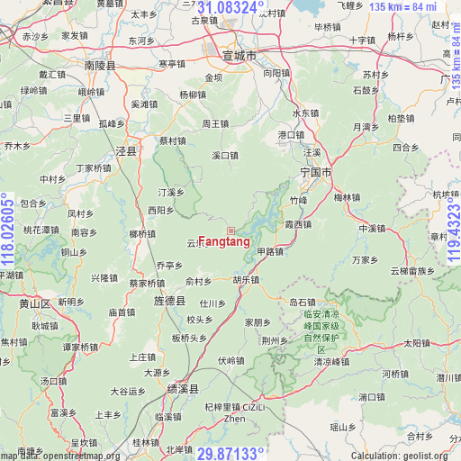
Fangtang GPS coordinates[2]
30° 28' 45.012" North, 118° 43' 45.012" East
| Map corner | latitude | longitude |
|---|---|---|
| Upper-left | 31.08324°, | 118.02605° |
| Center: | 30.47917°, | 118.72917° |
| Lower-right: | 29.87133°, | 119.4323° |
| Map W x H: | 134.8×134.8 km | = 83.8×83.8mi |
| max Lat: | 53.31946° ⇑49.8% North |
| Fangtang: | 30.47917° |
| min Lat: | ⇓50.2% South 18.22056° |
| min Long | Fangtang | max Long |
| 75.07348° | 118.72917° | 134.28917° |
| W 74.5%⇐ | ⇒25.5% E |
Elevation
Elevation of Fangtang is 143 m = 469 ft, and this is 341.8 m = 1121 ft below average elevation for this country.
| Max E: |
5622 m = 18445 ft | 53.1% |
| Avg. | 484.8 m = 1591 ft | |
| Fangtang | 143 m = 469 ft | |
Min E: |
-3 m = -10 ft | 46.9% |
See also: China elevation on elevation.city.
Geographical zone
Fangtang is located in North temperate zone (between Tropic of Cancer and the Arctic Circle). Distance of this Northern Tropic circle is 783 km =486.5 mi to South.| Distance of | km | miles | from Fangtang |
|---|---|---|---|
| North Pole | 6618.1 | 4112.3 | to North |
| Arctic Circle | 4012.2 | 2493.1 | to North |
| Tropic Cancer | 783 | 486.5 | to South |
| Equator | 3389 | 2105.8 | to South |


Nearby cities:
15 places around Fangtang: (largest is in red/bold)
• Aimin
21.6 km =13.4 mi,  330°
330°
• Guxi
22.3 km =13.9 mi,  354°
354°
• Hule
14.6 km =9.1 mi,  163°
163°
• Jialu
12.6 km =7.8 mi,  117°
117°
• Jingqiao
22.7 km =14.1 mi,  216°
216°
• Qiaoting
20.2 km =12.6 mi,  240°
240°
• Qinglong
22.7 km =14.1 mi,  46°
46°
• Shichuan
21.3 km =13.2 mi,  195°
195°
• Suhong
20.8 km =12.9 mi,  302°
302°
• Tingxi
18.2 km =11.3 mi,  321°
321°
• Xiaxi
19.7 km =12.2 mi,  83°
83°
• Xiyang
21.4 km =13.3 mi,  286°
286°
• Yucun
17.3 km =10.7 mi,  212°
212°
• Yunle
9.7 km =6 mi,  250°
250°
• Zhufeng
22.2 km =13.8 mi,  63°
63°
Sources, notices
• [Note1] Compared only with cities in China existing in our database
• [Src1] Map data: © OpenStreetMap contributors (CC-BY-SA)
• [Src2] Other city data from geonames.org with taken over terms of usage.
• [Src3] Geographical zone / Annual Mean Temperature by Robert A. Rohde @ Wikipedia
