Zhufeng geodata
Zhufeng (Anhui) is a seat of a fourth-order administrative division; located in China in Asia/Shanghai (GMT+8) time zone. In our database, there are 1268 cities with bigger population. Compared to other cities in China, 50.9% of cities are located further ↓South; 75.7% of cities are located further ←West and 60.6% of cities have higher elevation than Zhufeng. Note1


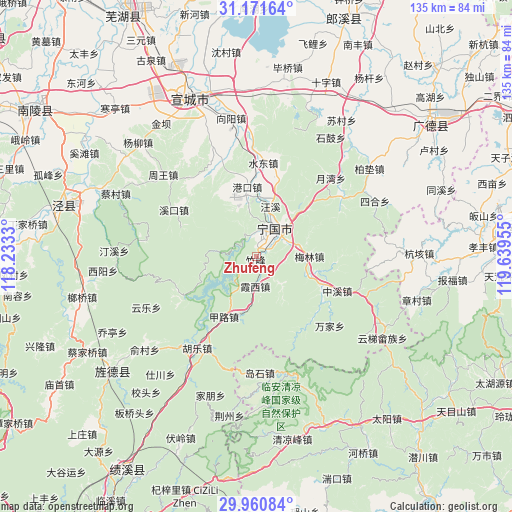
Zhufeng GPS coordinates[2]
30° 34' 5.268" North, 118° 56' 11.112" East
| Map corner | latitude | longitude |
|---|---|---|
| Upper-left | 31.17164°, | 118.2333° |
| Center: | 30.56813°, | 118.93642° |
| Lower-right: | 29.96084°, | 119.63955° |
| Map W x H: | 134.6×134.6 km | = 83.6×83.6mi |
| max Lat: | 53.31946° ⇑49.1% North |
| Zhufeng: | 30.56813° |
| min Lat: | ⇓50.9% South 18.22056° |
| min Long | Zhufeng | max Long |
| 75.07348° | 118.93642° | 134.28917° |
| W 75.7%⇐ | ⇒24.3% E |
Elevation
Elevation of Zhufeng is 95 m = 312 ft, and this is 389.8 m = 1279 ft below average elevation for this country.
| Max E: |
5622 m = 18445 ft | 60.6% |
| Avg. | 484.8 m = 1591 ft | |
| Zhufeng | 95 m = 312 ft | |
Min E: |
-3 m = -10 ft | 39.4% |
See also: China elevation on elevation.city.
Geographical zone
Zhufeng is located in North temperate zone (between Tropic of Cancer and the Arctic Circle). Distance of this Northern Tropic circle is 792.9 km =492.7 mi to South.| Distance of | km | miles | from Zhufeng |
|---|---|---|---|
| North Pole | 6608.2 | 4106.1 | to North |
| Arctic Circle | 4002.3 | 2486.9 | to North |
| Tropic Cancer | 792.9 | 492.7 | to South |
| Equator | 3398.9 | 2112 | to South |


Nearby cities:
15 places around Zhufeng: (largest is in red/bold)
• Fangtang
22.2 km =13.8 mi,  243°
243°
• Gangkou
18.5 km =11.5 mi,  352°
352°
• Guxi
25.1 km =15.6 mi,  299°
299°
• Helixi
8 km =5 mi,  32°
32°
• Honglong
10.1 km =6.3 mi,  139°
139°
• Jialu
17.9 km =11.1 mi,  208°
208°
• Meilin
13.8 km =8.6 mi,  90°
90°
• Ningdun
20.5 km =12.7 mi,  126°
126°
• Qinglong
6.8 km =4.2 mi,  329°
329°
• Shuidong
24.5 km =15.2 mi,  4°
4°
• Wangxi
13.6 km =8.5 mi,  14°
14°
• Xiaxi
7.6 km =4.7 mi,  182°
182°
• Yalukou
12.8 km =8 mi,  35°
35°
• Zhongxi
23.1 km =14.4 mi,  113°
113°
• Zhujiaqiao
22.6 km =14 mi,  146°
146°
Sources, notices
• [Note1] Compared only with cities in China existing in our database
• [Src1] Map data: © OpenStreetMap contributors (CC-BY-SA)
• [Src2] Other city data from geonames.org with taken over terms of usage.
• [Src3] Geographical zone / Annual Mean Temperature by Robert A. Rohde @ Wikipedia
