El Piñón geodata
El Piñón (Magdalena) is a seat of a second-order administrative division; located in Colombia in America/Bogota (GMT-5) time zone. With population of 7,481 people, there are 391 cities with bigger population in this country. Compared to other cities in Colombia, 95.4% of cities are located further ↓South; 50.1% of cities are located further ←West and 97.1% of cities have higher elevation than El Piñón. Note1


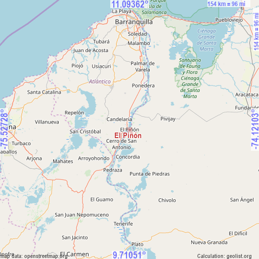
El Piñón GPS coordinates[2]
10° 24' 10.188" North, 74° 49' 26.94" West
| Map corner | latitude | longitude |
|---|---|---|
| Upper-left | 11.09362°, | -75.52728° |
| Center: | 10.40283°, | -74.82415° |
| Lower-right: | 9.71051°, | -74.12103° |
| Map W x H: | 153.8×153.8 km | = 95.6×95.6mi |
| max Lat: | 13.38166° ⇑4.6% North |
| El Piñón: | 10.40283° |
| min Lat: | ⇓95.4% South -4.21528° |
| min Long | El Piñón | max Long |
| -81.70636° | -74.82415° | -67.06996° |
| W 50.1%⇐ | ⇒49.9% E |
Elevation
Elevation of El Piñón is 9 m = 30 ft, and this is 1140.3 m = 3741 ft below average elevation for this country.
| Max E: |
3342 m = 10965 ft | 97.1% |
| Avg. | 1149.3 m = 3771 ft | |
| El Piñón | 9 m = 30 ft | |
Min E: |
1 m = 3 ft | 2.9% |
See also: Colombia elevation on elevation.city.
Geographical zone
El Piñón is located in North Torrid zone (between Equator and Tropic of Cancer). Distance of Equator is 1156.7 km =718.7 mi to South.| Distance of | km | miles | from El Piñón |
|---|---|---|---|
| North Pole | 8850.4 | 5499.4 | to North |
| Arctic Circle | 6244.5 | 3880.2 | to North |
| Tropic Cancer | 1449.2 | 900.5 | to North |
| Equator | 1156.7 | 718.7 | to South |


Nearby cities:
15 places around El Piñón: (largest is in red/bold)
• Arroyohondo
27.2 km =16.9 mi,  231°
231°
• Calamar
19.5 km =12.1 mi,  210°
210°
• Campo de la Cruz
7.1 km =4.4 mi,  247°
247°
• Candelaria
8.7 km =5.4 mi,  315°
315°
• Cerro de San Antonio
9.9 km =6.2 mi, 209°
• Concordia
16.2 km =10.1 mi,  183°
183°
• Manatí
15.5 km =9.6 mi,  288°
288°
• Pedraza
25.9 km =16.1 mi,  202°
202°
• Pivijay
23.7 km =14.7 mi,  73°
73°
• Ponedera
27.8 km =17.3 mi,  16°
16°
• Sabanalarga
27.5 km =17.1 mi,  337°
337°
• Salamina
10.2 km =6.3 mi, 18°
• San Cristóbal
26.4 km =16.4 mi,  268°
268°
• Santa Lucía
17.3 km =10.7 mi,  239°
239°
• Suan
9.8 km =6.1 mi,  218°
218°
Sources, notices
• [Note1] Compared only with cities in Colombia existing in our database
• [Src1] Map data: © OpenStreetMap contributors (CC-BY-SA)
• [Src2] Other city data from geonames.org with taken over terms of usage.
• [Src3] Geographical zone / Annual Mean Temperature by Robert A. Rohde @ Wikipedia
