El Guacamayo geodata
El Guacamayo (Santander) is a seat of a second-order administrative division; located in Colombia in America/Bogota (GMT-5) time zone. With population of 428 people, there are 1032 cities with bigger population in this country. Compared to other cities in Colombia, 63.6% of cities are located further ↓South; 75.4% of cities are located further ←West and 78% of cities have lower elevation than El Guacamayo. Note1


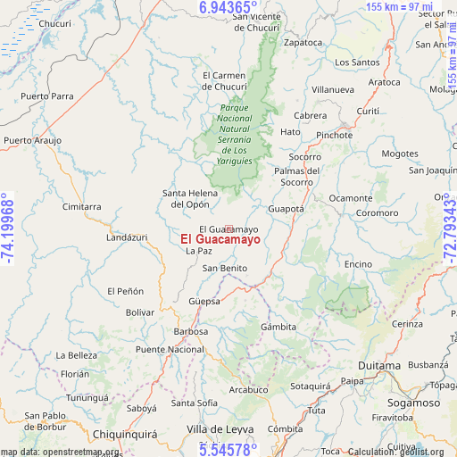
El Guacamayo GPS coordinates[2]
6° 14' 42.648" North, 73° 29' 47.58" West
| Map corner | latitude | longitude |
|---|---|---|
| Upper-left | 6.94365°, | -74.19968° |
| Center: | 6.24518°, | -73.49655° |
| Lower-right: | 5.54578°, | -72.79343° |
| Map W x H: | 155.4×155.4 km | = 96.6×96.6mi |
| max Lat: | 13.38166° ⇑36.4% North |
| El Guacamayo: | 6.24518° |
| min Lat: | ⇓63.6% South -4.21528° |
| min Long | El Guacamayo | max Long |
| -81.70636° | -73.49655° | -67.06996° |
| W 75.4%⇐ | ⇒24.6% E |
Elevation
Elevation of El Guacamayo is 1974 m = 6476 ft, and this is 824.7 m = 2706 ft above average elevation for this country.
| Max E: |
3342 m = 10965 ft | 22% |
| El Guacamayo | 1974 m 6476 ft | |
| Avg. | 1149.3 m = 3771 ft | |
Min E: |
1 m = 3 ft | 78% |
See also: Colombia elevation on elevation.city.
Geographical zone
El Guacamayo is located in North Torrid zone (between Equator and Tropic of Cancer). Distance of Equator is 694.4 km =431.5 mi to South.| Distance of | km | miles | from El Guacamayo |
|---|---|---|---|
| North Pole | 9312.7 | 5786.6 | to North |
| Arctic Circle | 6706.8 | 4167.4 | to North |
| Tropic Cancer | 1911.5 | 1187.8 | to North |
| Equator | 694.4 | 431.5 | to South |


Nearby cities:
15 places around El Guacamayo: (largest is in red/bold)
• Aguada
9.6 km =6 mi,  197°
197°
• Chima
17.5 km =10.9 mi,  50°
50°
• Chipatá
25.6 km =15.9 mi,  217°
217°
• Chitaraque
24.7 km =15.3 mi,  167°
167°
• Contratación
5.6 km =3.5 mi,  27°
27°
• Guadalupe
8.6 km =5.3 mi,  89°
89°
• Guapotá
20.7 km =12.9 mi,  70°
70°
• La Paz
12.7 km =7.9 mi,  234°
234°
• Oiba
22 km =13.7 mi,  84°
84°
• San Benito
12.5 km =7.8 mi,  177°
177°
• San José de Pare
25.9 km =16.1 mi,  192°
192°
• Santa Helena
11.4 km =7.1 mi,  302°
302°
• Santa Helena del Opón
17 km =10.6 mi,  308°
308°
• Santana
20.9 km =13 mi, 175°
• Suaita
17.1 km =10.6 mi,  158°
158°
Sources, notices
• [Note1] Compared only with cities in Colombia existing in our database
• [Src1] Map data: © OpenStreetMap contributors (CC-BY-SA)
• [Src2] Other city data from geonames.org with taken over terms of usage.
• [Src3] Geographical zone / Annual Mean Temperature by Robert A. Rohde @ Wikipedia
