Suaita geodata
Suaita (Santander) is a seat of a second-order administrative division; located in Colombia in America/Bogota (GMT-5) time zone. With population of 2,691 people, there are 718 cities with bigger population in this country. Compared to other cities in Colombia, 61.2% of cities are located further ↓South; 77.2% of cities are located further ←West and 66.8% of cities have lower elevation than Suaita. Note1


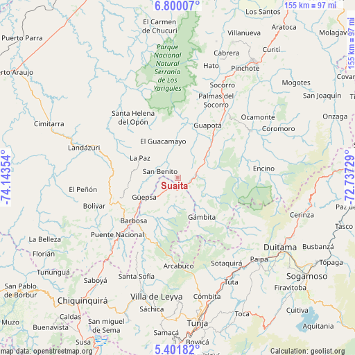
Suaita GPS coordinates[2]
6° 6' 5.04" North, 73° 26' 25.476" West
| Map corner | latitude | longitude |
|---|---|---|
| Upper-left | 6.80007°, | -74.14354° |
| Center: | 6.1014°, | -73.44041° |
| Lower-right: | 5.40182°, | -72.73729° |
| Map W x H: | 155.5×155.5 km | = 96.6×96.6mi |
| max Lat: | 13.38166° ⇑38.8% North |
| Suaita: | 6.1014° |
| min Lat: | ⇓61.2% South -4.21528° |
| min Long | Suaita | max Long |
| -81.70636° | -73.44041° | -67.06996° |
| W 77.2%⇐ | ⇒22.8% E |
Elevation
Elevation of Suaita is 1641 m = 5384 ft, and this is 491.7 m = 1613 ft above average elevation for this country.
| Max E: |
3342 m = 10965 ft | 33.2% |
| Suaita | 1641 m 5384 ft | |
| Avg. | 1149.3 m = 3771 ft | |
Min E: |
1 m = 3 ft | 66.8% |
See also: Colombia elevation on elevation.city.
Geographical zone
Suaita is located in North Torrid zone (between Equator and Tropic of Cancer). Distance of Equator is 678.4 km =421.5 mi to South.| Distance of | km | miles | from Suaita |
|---|---|---|---|
| North Pole | 9328.6 | 5796.5 | to North |
| Arctic Circle | 6722.8 | 4177.4 | to North |
| Tropic Cancer | 1927.5 | 1197.7 | to North |
| Equator | 678.4 | 421.5 | to South |


Nearby cities:
15 places around Suaita: (largest is in red/bold)
• Aguada
11.3 km =7 mi,  306°
306°
• Chipatá
22.2 km =13.8 mi,  258°
258°
• Chitaraque
8.2 km =5.1 mi,  185°
185°
• Contratación
21.3 km =13.2 mi,  350°
350°
• El Guacamayo
17.1 km =10.6 mi,  338°
338°
• Guadalupe
16.3 km =10.1 mi,  8°
8°
• Guapotá
26.5 km =16.5 mi,  30°
30°
• Gámbita
20.3 km =12.6 mi,  148°
148°
• Güepsa
17 km =10.6 mi,  239°
239°
• La Paz
18.6 km =11.6 mi,  297°
297°
• Oiba
23.9 km =14.9 mi,  40°
40°
• San Benito
6.6 km =4.1 mi, 302°
• San José de Pare
15 km =9.3 mi,  231°
231°
• Santana
6.6 km =4.1 mi,  222°
222°
• Togüí
20.2 km =12.6 mi,  203°
203°
Sources, notices
• [Note1] Compared only with cities in Colombia existing in our database
• [Src1] Map data: © OpenStreetMap contributors (CC-BY-SA)
• [Src2] Other city data from geonames.org with taken over terms of usage.
• [Src3] Geographical zone / Annual Mean Temperature by Robert A. Rohde @ Wikipedia
