Carlosama geodata
Carlosama (Nariño) is a seat of a second-order administrative division; located in Colombia in America/Bogota (GMT-5) time zone. With population of 2,010 people, there are 798 cities with bigger population in this country. Compared to other cities in Colombia, 98.8% of cities are located further ↑North; 98.4% of cities are located further →East and 99.2% of cities have lower elevation than Carlosama. Note1


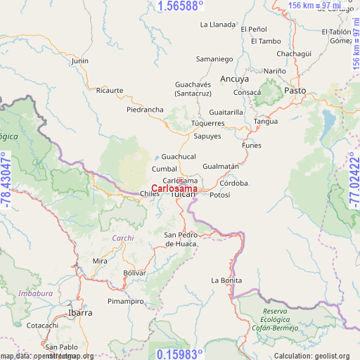
Carlosama GPS coordinates[2]
0° 51' 46.512" North, 77° 43' 38.424" West
| Map corner | latitude | longitude |
|---|---|---|
| Upper-left | 1.56588°, | -78.43047° |
| Center: | 0.86292°, | -77.72734° |
| Lower-right: | 0.15983°, | -77.02422° |
| Map W x H: | 156.3×156.3 km | = 97.1×97.1mi |
| max Lat: | 13.38166° ⇑98.8% North |
| Carlosama: | 0.86292° |
| min Lat: | ⇓1.2% South -4.21528° |
| min Long | Carlosama | max Long |
| -81.70636° | -77.72734° | -67.06996° |
| W 1.6%⇐ | ⇒98.4% E |
Elevation
Elevation of Carlosama is 3027 m = 9931 ft, and this is 1877.7 m = 6160 ft above average elevation for this country.
| Max E: |
3342 m = 10965 ft | 0.8% |
| Carlosama | 3027 m 9931 ft | |
| Avg. | 1149.3 m = 3771 ft | |
Min E: |
1 m = 3 ft | 99.2% |
See also: Colombia elevation on elevation.city.
Geographical zone
Carlosama is located in North Torrid zone (between Equator and Tropic of Cancer). Distance of Equator is 95.9 km =59.6 mi to South.| Distance of | km | miles | from Carlosama |
|---|---|---|---|
| North Pole | 9911.1 | 6158.5 | to North |
| Arctic Circle | 7305.2 | 4539.2 | to North |
| Tropic Cancer | 2510 | 1559.6 | to North |
| Equator | 95.9 | 59.6 | to South |


Nearby cities:
15 places around Carlosama: (largest is in red/bold)
• Aldana
3.7 km =2.3 mi,  52°
52°
• Contadero
20.6 km =12.8 mi,  75°
75°
• Cumbal
8.8 km =5.5 mi,  305°
305°
• Córdoba
23.3 km =14.5 mi,  92°
92°
• Guachucal
10.9 km =6.8 mi,  357°
357°
• Gualmatán
18.9 km =11.7 mi,  70°
70°
• Iles
25.8 km =16 mi,  62°
62°
• Imués
33.4 km =20.8 mi, 50°
• Ipiales
10.6 km =6.6 mi,  113°
113°
• Ospina
28.3 km =17.6 mi,  39°
39°
• Potosí
18.3 km =11.4 mi, 109°
• Puerres
25 km =15.5 mi, 84°
• Pupiales
9.7 km =6 mi, 84°
• Sapuyes
22.7 km =14.1 mi,  31°
31°
• Túquerres
27.6 km =17.1 mi, 25°
Sources, notices
• [Note1] Compared only with cities in Colombia existing in our database
• [Src1] Map data: © OpenStreetMap contributors (CC-BY-SA)
• [Src2] Other city data from geonames.org with taken over terms of usage.
• [Src3] Geographical zone / Annual Mean Temperature by Robert A. Rohde @ Wikipedia
