Buenavista geodata
Buenavista (Córdoba) is a populated place; located in Colombia in America/Bogota (GMT-5) time zone. With population of 5,062 people, there are 504 cities with bigger population in this country. Compared to other cities in Colombia, 87.3% of cities are located further ↓South; 80.2% of cities are located further →East and 82.4% of cities have higher elevation than Buenavista. Note1


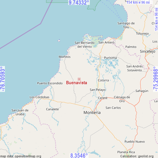
Buenavista GPS coordinates[2]
9° 2' 58.668" North, 76° 0' 10.08" West
| Map corner | latitude | longitude |
|---|---|---|
| Upper-left | 9.74332°, | -76.70593° |
| Center: | 9.04963°, | -76.0028° |
| Lower-right: | 8.3546°, | -75.29968° |
| Map W x H: | 154.4×154.4 km | = 95.9×95.9mi |
| max Lat: | 13.38166° ⇑12.7% North |
| Buenavista: | 9.04963° |
| min Lat: | ⇓87.3% South -4.21528° |
| min Long | Buenavista | max Long |
| -81.70636° | -76.0028° | -67.06996° |
| W 19.8%⇐ | ⇒80.2% E |
Elevation
Elevation of Buenavista is 89 m = 292 ft, and this is 1060.3 m = 3479 ft below average elevation for this country.
| Max E: |
3342 m = 10965 ft | 82.4% |
| Avg. | 1149.3 m = 3771 ft | |
| Buenavista | 89 m = 292 ft | |
Min E: |
1 m = 3 ft | 17.6% |
See also: Colombia elevation on elevation.city.
Geographical zone
Buenavista is located in North Torrid zone (between Equator and Tropic of Cancer). Distance of Equator is 1006.2 km =625.2 mi to South.| Distance of | km | miles | from Buenavista |
|---|---|---|---|
| North Pole | 9000.8 | 5592.8 | to North |
| Arctic Circle | 6394.9 | 3973.6 | to North |
| Tropic Cancer | 1599.7 | 994 | to North |
| Equator | 1006.2 | 625.2 | to South |


Nearby cities:
15 places around Buenavista: (largest is in red/bold)
• Canalete
39.3 km =24.4 mi,  221°
221°
• Cereté
29.7 km =18.5 mi,  128°
128°
• Chimá
42.6 km =26.5 mi,  74°
74°
• Cotorra
23.4 km =14.5 mi,  92°
92°
• Lorica
29.4 km =18.3 mi,  45°
45°
• Los Córdobas
42.3 km =26.3 mi,  245°
245°
• Momil
41.6 km =25.8 mi,  59°
59°
• Montería
36.1 km =22.4 mi,  158°
158°
• Moñitos
25.9 km =16.1 mi,  327°
327°
• Puerto Escondido
28.9 km =18 mi,  263°
263°
• Purísima de la Concepción
37.2 km =23.1 mi, 56°
• San Antero
44.9 km =27.9 mi,  36°
36°
• San Bernardo del Viento
34.2 km =21.3 mi,  9°
9°
• San Carlos
43.7 km =27.2 mi, 130°
• San Pelayo
20.9 km =13 mi,  119°
119°
Sources, notices
• [Note1] Compared only with cities in Colombia existing in our database
• [Src1] Map data: © OpenStreetMap contributors (CC-BY-SA)
• [Src2] Other city data from geonames.org with taken over terms of usage.
• [Src3] Geographical zone / Annual Mean Temperature by Robert A. Rohde @ Wikipedia
