San Juan geodata
San Juan (San José) is a populated place; located in Costa Rica in America/Costa_Rica (GMT-6) time zone. With population of 26,047 people, there are 21 cities with bigger population in this country. Compared to other cities in Costa Rica, 52.2% of cities are located further ↑North; 59.7% of cities are located further ←West and 71.6% of cities have lower elevation than San Juan. Note1


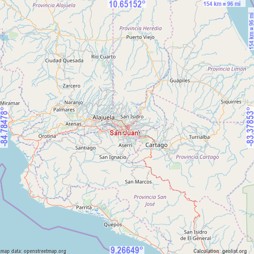
San Juan GPS coordinates[2]
9° 57' 35.064" North, 84° 4' 53.94" West
| Map corner | latitude | longitude |
|---|---|---|
| Upper-left | 10.65152°, | -84.78478° |
| Center: | 9.95974°, | -84.08165° |
| Lower-right: | 9.26649°, | -83.37853° |
| Map W x H: | 154×154 km | = 95.7×95.7mi |
| max Lat: | 11.07377° ⇑52.2% North |
| San Juan: | 9.95974° |
| min Lat: | ⇓47.8% South 8.53305° |
| min Long | San Juan | max Long |
| -85.64748° | -84.08165° | -82.62185° |
| W 59.7%⇐ | ⇒40.3% E |
Elevation
Elevation of San Juan is 1151 m = 3776 ft, and this is 416 m = 1365 ft above average elevation for this country.
| Max E: |
1844 m = 6050 ft | 28.4% |
| San Juan | 1151 m 3776 ft | |
| Avg. | 735 m = 2411 ft | |
Min E: |
7 m = 23 ft | 71.6% |
See also: Costa Rica elevation on elevation.city.
Geographical zone
San Juan is located in North Torrid zone (between Equator and Tropic of Cancer). Distance of Equator is 1107.4 km =688.1 mi to South.| Distance of | km | miles | from San Juan |
|---|---|---|---|
| North Pole | 8899.6 | 5530 | to North |
| Arctic Circle | 6293.8 | 3910.8 | to North |
| Tropic Cancer | 1498.5 | 931.1 | to North |
| Equator | 1107.4 | 688.1 | to South |


Nearby cities:
15 places around San Juan: (largest is in red/bold)
• Calle Blancos
2 km =1.2 mi,  123°
123°
• Colima
1 km =0.6 mi,  200°
200°
• Guadalupe
3 km =1.9 mi, 115°
• Heredia
6.1 km =3.8 mi,  321°
321°
• Purral
5.6 km =3.5 mi,  91°
91°
• Sabanilla
4.9 km =3 mi,  109°
109°
• San Felipe
6.6 km =4.1 mi, 203°
• San Francisco
6.4 km =4 mi,  305°
305°
• San José
2.9 km =1.8 mi,  183°
183°
• San Pablo
4.3 km =2.7 mi,  337°
337°
• San Pedro
4.9 km =3 mi,  135°
135°
• San Rafael
6.3 km =3.9 mi, 341°
• San Vicente
3.7 km =2.3 mi, 89°
• San Vicente de Moravia
3.6 km =2.2 mi, 86°
• Ángeles
5.2 km =3.2 mi,  39°
39°
Sources, notices
• [Note1] Compared only with cities in Costa Rica existing in our database
• [Src1] Map data: © OpenStreetMap contributors (CC-BY-SA)
• [Src2] Other city data from geonames.org with taken over terms of usage.
• [Src3] Geographical zone / Annual Mean Temperature by Robert A. Rohde @ Wikipedia
