Heredia geodata
Heredia is a seat of a first-order administrative division; located in Costa Rica in America/Costa_Rica (GMT-6) time zone. With population of 21,947 people, there are 29 cities with bigger population in this country. Compared to other cities in Costa Rica, 60.4% of cities are located further ↓South; 50.7% of cities are located further ←West and 73.1% of cities have lower elevation than Heredia. Note1


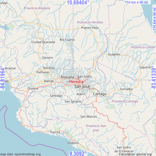
Heredia GPS coordinates[2]
10° 0' 8.496" North, 84° 6' 59.436" West
| Map corner | latitude | longitude |
|---|---|---|
| Upper-left | 10.69404°, | -84.81964° |
| Center: | 10.00236°, | -84.11651° |
| Lower-right: | 9.3092°, | -83.41339° |
| Map W x H: | 154×154 km | = 95.7×95.7mi |
| max Lat: | 11.07377° ⇑39.6% North |
| Heredia: | 10.00236° |
| min Lat: | ⇓60.4% South 8.53305° |
| min Long | Heredia | max Long |
| -85.64748° | -84.11651° | -82.62185° |
| W 50.7%⇐ | ⇒49.3% E |
Elevation
Elevation of Heredia is 1174 m = 3852 ft, and this is 439 m = 1440 ft above average elevation for this country.
| Max E: |
1844 m = 6050 ft | 26.9% |
| Heredia | 1174 m 3852 ft | |
| Avg. | 735 m = 2411 ft | |
Min E: |
7 m = 23 ft | 73.1% |
See also: Costa Rica elevation on elevation.city.
Geographical zone
Heredia is located in North Torrid zone (between Equator and Tropic of Cancer). Distance of Equator is 1112.2 km =691.1 mi to South.| Distance of | km | miles | from Heredia |
|---|---|---|---|
| North Pole | 8894.9 | 5527 | to North |
| Arctic Circle | 6289 | 3907.8 | to North |
| Tropic Cancer | 1493.8 | 928.2 | to North |
| Equator | 1112.2 | 691.1 | to South |


Nearby cities:
15 places around Heredia: (largest is in red/bold)
• Calle Blancos
8 km =5 mi,  136°
136°
• Colima
6.7 km =4.2 mi,  148°
148°
• La Asunción
6.7 km =4.2 mi,  247°
247°
• Llorente
4.2 km =2.6 mi,  264°
264°
• Mercedes
2 km =1.2 mi,  284°
284°
• San Antonio
7.6 km =4.7 mi, 253°
• San Francisco
1.7 km =1.1 mi,  233°
233°
• San Josecito
2.4 km =1.5 mi,  48°
48°
• San José
8.5 km =5.3 mi, 154°
• San Juan
6.1 km =3.8 mi, 141°
• San Pablo
2.3 km =1.4 mi,  109°
109°
• San Rafael
2.2 km =1.4 mi,  56°
56°
• San Rafael
8.6 km =5.3 mi,  195°
195°
• Santo Domingo
8 km =5 mi,  328°
328°
• Ángeles
7.2 km =4.5 mi,  95°
95°
Sources, notices
• [Note1] Compared only with cities in Costa Rica existing in our database
• [Src1] Map data: © OpenStreetMap contributors (CC-BY-SA)
• [Src2] Other city data from geonames.org with taken over terms of usage.
• [Src3] Geographical zone / Annual Mean Temperature by Robert A. Rohde @ Wikipedia
