Dulce Nombre de Jesus geodata
Dulce Nombre de Jesus (San José) is a seat of a third-order administrative division; located in Costa Rica in America/Costa_Rica (GMT-6) time zone. In our database, there are 124 cities with bigger population. Compared to other cities in Costa Rica, 78.4% of cities are located further ↓South; 76.1% of cities are located further ←West and 58.2% of cities have higher elevation than Dulce Nombre de Jesus. Note1
Administrative division(s):
- Level 1: San José
- Level 2: Vázquez de Coronado
- Level 3: Dulce Nombre de Jesús
Current local time in Dulce Nombre de Jesus:
05:34 AM, WednesdayDifference from your time zone: hours


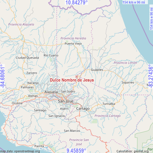
Dulce Nombre de Jesus GPS coordinates[2]
10° 9' 5.184" North, 83° 58' 38.928" West
| Map corner | latitude | longitude |
|---|---|---|
| Upper-left | 10.84279°, | -84.68061° |
| Center: | 10.15144°, | -83.97748° |
| Lower-right: | 9.45859°, | -83.27436° |
| Map W x H: | 153.9×153.9 km | = 95.6×95.6mi |
| max Lat: | 11.07377° ⇑21.6% North |
| Dulce Nombre de Jesus: | 10.15144° |
| min Lat: | ⇓78.4% South 8.53305° |
| min Long | Dulce Nombre de | max Long |
| -85.64748° | -83.97748° | -82.62185° |
| W 76.1%⇐ | ⇒23.9% E |
Elevation
Elevation of Dulce Nombre de Jesus is 634 m = 2080 ft, and this is 101 m = 331 ft below average elevation for this country.
| Max E: |
1844 m = 6050 ft | 58.2% |
| Avg. | 735 m = 2411 ft | |
| Dulce Nombre de Jesus | 634 m = 2080 ft | |
Min E: |
7 m = 23 ft | 41.8% |
See also: Costa Rica elevation on elevation.city.
Geographical zone
Dulce Nombre de Jesus is located in North Torrid zone (between Equator and Tropic of Cancer). Distance of Equator is 1128.7 km =701.3 mi to South.| Distance of | km | miles | from Dulce Nombre de Jesus |
|---|---|---|---|
| North Pole | 8878.3 | 5516.7 | to North |
| Arctic Circle | 6272.4 | 3897.5 | to North |
| Tropic Cancer | 1477.2 | 917.9 | to North |
| Equator | 1128.7 | 701.3 | to South |


Nearby cities:
15 places around Dulce Nombre de Jesus: (largest is in red/bold)
• Guadalupe
24.2 km =15 mi,  200°
200°
• Guápiles
22.3 km =13.9 mi,  70°
70°
• Heredia
22.5 km =14 mi,  222°
222°
• Ipís
20.8 km =12.9 mi,  190°
190°
• Jiménez
22.3 km =13.9 mi,  85°
85°
• Mercedes
23.5 km =14.6 mi,  226°
226°
• Purral
22.3 km =13.9 mi, 195°
• Sabanilla
23.9 km =14.9 mi, 196°
• San Josecito
20.1 km =12.5 mi, 221°
• San Pablo
21.7 km =13.5 mi, 216°
• San Rafael
20.4 km =12.7 mi, 221°
• San Vicente
22.6 km =14 mi, 199°
• San Vicente de Moravia
22.5 km =14 mi, 200°
• Santo Domingo
21.7 km =13.5 mi,  243°
243°
• Ángeles
19.1 km =11.9 mi,  205°
205°
Sources, notices
• [Note1] Compared only with cities in Costa Rica existing in our database
• [Src1] Map data: © OpenStreetMap contributors (CC-BY-SA)
• [Src2] Other city data from geonames.org with taken over terms of usage.
• [Src3] Geographical zone / Annual Mean Temperature by Robert A. Rohde @ Wikipedia
