Albrechtice geodata
Albrechtice (Moravskoslezský) is a populated place; located in Czech Republic in Europe/Prague (GMT+2) time zone. With population of 4,019 people, there are 337 cities with bigger population in this country. Compared to other cities in Czech Republic, 51.1% of cities are located further ↓South; 99% of cities are located further ←West and 70.3% of cities have higher elevation than Albrechtice. Note1


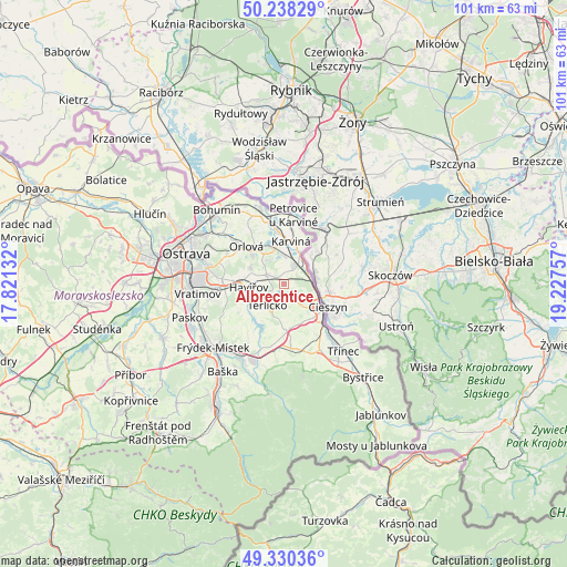
Albrechtice GPS coordinates[2]
49° 47' 11.22" North, 18° 31' 27.984" East
| Map corner | latitude | longitude |
|---|---|---|
| Upper-left | 50.23829°, | 17.82132° |
| Center: | 49.78645°, | 18.52444° |
| Lower-right: | 49.33036°, | 19.22757° |
| Map W x H: | 101×101 km | = 62.8×62.8mi |
| max Lat: | 51.01104° ⇑48.9% North |
| Albrechtice: | 49.78645° |
| min Lat: | ⇓51.1% South 48.60378° |
| min Long | Albrechtice | max Long |
| 12.17577° | 18.52444° | 18.82683° |
| W 99%⇐ | ⇒1% E |
Elevation
Elevation of Albrechtice is 256 m = 840 ft, and this is 96 m = 315 ft below average elevation for this country.
| Max E: |
901 m = 2956 ft | 70.3% |
| Avg. | 352 m = 1155 ft | |
| Albrechtice | 256 m = 840 ft | |
Min E: |
136 m = 446 ft | 29.7% |
See also: Czech Republic elevation on elevation.city.
Geographical zone
Albrechtice is located in North temperate zone (between Tropic of Cancer and the Arctic Circle). Distance of this North polar circle is 1865.4 km =1159.1 mi to North.| Distance of | km | miles | from Albrechtice |
|---|---|---|---|
| North Pole | 4471.3 | 2778.3 | to North |
| Arctic Circle | 1865.4 | 1159.1 | to North |
| Tropic Cancer | 2929.8 | 1820.5 | to South |
| Equator | 5535.7 | 3439.7 | to South |


Nearby cities:
15 places around Albrechtice: (largest is in red/bold)
• Chotěbuz
3.8 km =2.4 mi,  121°
121°
• Dolní Domaslavice
9.2 km =5.7 mi,  201°
201°
• Doubrava
8.6 km =5.3 mi,  338°
338°
• Havířov
6.3 km =3.9 mi,  263°
263°
• Horní Bludovice
7.5 km =4.7 mi,  236°
236°
• Horní Suchá
3.3 km =2.1 mi,  292°
292°
• Horní Těrlicko
4.9 km =3 mi,  217°
217°
• Karviná
7.6 km =4.7 mi,  9°
9°
• Lučina
9.1 km =5.7 mi, 217°
• Orlová
9.4 km =5.8 mi,  314°
314°
• Petřvald
10.9 km =6.8 mi,  297°
297°
• Ropice
11.1 km =6.9 mi,  144°
144°
• Stonava
3.4 km =2.1 mi,  0°
0°
• Český Těšín
8.6 km =5.3 mi, 121°
• Šenov
10.7 km =6.6 mi,  274°
274°
Sources, notices
• [Note1] Compared only with cities in Czech Republic existing in our database
• [Src1] Map data: © OpenStreetMap contributors (CC-BY-SA)
• [Src2] Other city data from geonames.org with taken over terms of usage.
• [Src3] Geographical zone / Annual Mean Temperature by Robert A. Rohde @ Wikipedia
