Wrohm geodata
Wrohm (Schleswig-Holstein) is a seat of a fourth-order administrative division; located in Germany in Europe/Berlin (GMT+2) time zone. With population of 740 people, there are 8154 cities with bigger population in this country. Compared to other cities in Germany, 95.3% of cities are located further ↓South; 59.6% of cities are located further →East and 88.9% of cities have higher elevation than Wrohm. Note1


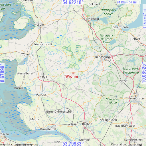
Wrohm GPS coordinates[2]
54° 12' 46.98" North, 9° 22' 55.632" East
| Map corner | latitude | longitude |
|---|---|---|
| Upper-left | 54.62218°, | 8.67899° |
| Center: | 54.21305°, | 9.38212° |
| Lower-right: | 53.79983°, | 10.08525° |
| Map W x H: | 91.4×91.4 km | = 56.8×56.8mi |
| max Lat: | 55.01917° ⇑4.7% North |
| Wrohm: | 54.21305° |
| min Lat: | ⇓95.3% South 47.40724° |
| min Long | Wrohm | max Long |
| 5.92978° | 9.38212° | 14.98853° |
| W 40.4%⇐ | ⇒59.6% E |
Elevation
Elevation of Wrohm is 24 m = 79 ft, and this is 225.1 m = 739 ft below average elevation for this country.
| Max E: |
1256 m = 4121 ft | 88.9% |
| Avg. | 249.1 m = 817 ft | |
| Wrohm | 24 m = 79 ft | |
Min E: |
-5 m = -16 ft | 11.1% |
See also: Germany elevation on elevation.city.
Geographical zone
Wrohm is located in North temperate zone (between Tropic of Cancer and the Arctic Circle). Distance of this North polar circle is 1373.2 km =853.3 mi to North.| Distance of | km | miles | from Wrohm |
|---|---|---|---|
| North Pole | 3979.1 | 2472.5 | to North |
| Arctic Circle | 1373.2 | 853.3 | to North |
| Tropic Cancer | 3422 | 2126.3 | to South |
| Equator | 6027.9 | 3745.6 | to South |


Nearby cities:
15 places around Wrohm: (largest is in red/bold)
• Bunsoh
6.7 km =4.2 mi,  217°
217°
• Dellstedt
2.5 km =1.6 mi,  335°
335°
• Dörpling
7.2 km =4.5 mi,  315°
315°
• Friedrichsgraben
6.4 km =4 mi,  20°
20°
• Hövede
6.7 km =4.2 mi,  307°
307°
• Immenstedt
6.3 km =3.9 mi,  238°
238°
• Offenbüttel
5.1 km =3.2 mi,  200°
200°
• Oldenbüttel
6.8 km =4.2 mi,  139°
139°
• Osterrade
2.5 km =1.6 mi, 235°
• Prinzenmoor
4.4 km =2.7 mi,  84°
84°
• Steenfeld
7.1 km =4.4 mi,  188°
188°
• Süderdorf
2.1 km =1.3 mi,  280°
280°
• Tackesdorf
7.4 km =4.6 mi,  116°
116°
• Tellingstedt
6.4 km =4 mi,  273°
273°
• Westerborstel
6.8 km =4.2 mi,  289°
289°
Sources, notices
• [Note1] Compared only with cities in Germany existing in our database
• [Src1] Map data: © OpenStreetMap contributors (CC-BY-SA)
• [Src2] Other city data from geonames.org with taken over terms of usage.
• [Src3] Geographical zone / Annual Mean Temperature by Robert A. Rohde @ Wikipedia
