Woltershausen geodata
Woltershausen (Lower Saxony) is a seat of a fourth-order administrative division; located in Germany in Europe/Berlin (GMT+2) time zone. With population of 963 people, there are 7301 cities with bigger population in this country. Compared to other cities in Germany, 72% of cities are located further ↓South; 50.8% of cities are located further →East and 54% of cities have higher elevation than Woltershausen. Note1


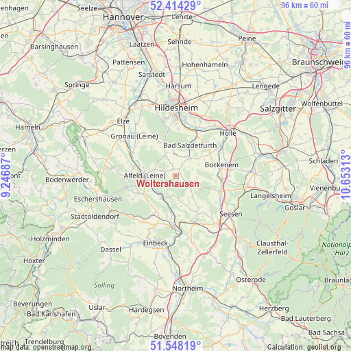
Woltershausen GPS coordinates[2]
51° 58' 59.988" North, 9° 57' 0" East
| Map corner | latitude | longitude |
|---|---|---|
| Upper-left | 52.41429°, | 9.24687° |
| Center: | 51.98333°, | 9.95° |
| Lower-right: | 51.54819°, | 10.65313° |
| Map W x H: | 96.3×96.3 km | = 59.8×59.8mi |
| max Lat: | 55.01917° ⇑28% North |
| Woltershausen: | 51.98333° |
| min Lat: | ⇓72% South 47.40724° |
| min Long | Woltershausen | max Long |
| 5.92978° | 9.95° | 14.98853° |
| W 49.2%⇐ | ⇒50.8% E |
Elevation
Elevation of Woltershausen is 197 m = 646 ft, and this is 52.1 m = 171 ft below average elevation for this country.
| Max E: |
1256 m = 4121 ft | 54% |
| Avg. | 249.1 m = 817 ft | |
| Woltershausen | 197 m = 646 ft | |
Min E: |
-5 m = -16 ft | 46% |
See also: Germany elevation on elevation.city.
Geographical zone
Woltershausen is located in North temperate zone (between Tropic of Cancer and the Arctic Circle). Distance of this North polar circle is 1621.2 km =1007.4 mi to North.| Distance of | km | miles | from Woltershausen |
|---|---|---|---|
| North Pole | 4227.1 | 2626.6 | to North |
| Arctic Circle | 1621.2 | 1007.4 | to North |
| Tropic Cancer | 3174.1 | 1972.3 | to South |
| Equator | 5780 | 3591.5 | to South |


Nearby cities:
15 places around Woltershausen: (largest is in red/bold)
• Adenstedt
2 km =1.2 mi,  328°
328°
• Alfeld
8.9 km =5.5 mi,  270°
270°
• Almstedt
5.5 km =3.4 mi,  8°
8°
• Bad Salzdetfurth
9.1 km =5.7 mi,  24°
24°
• Delligsen
11.1 km =6.9 mi,  245°
245°
• Eberholzen
10.1 km =6.3 mi,  317°
317°
• Everode
4.4 km =2.7 mi,  211°
211°
• Freden
7.3 km =4.5 mi, 212°
• Harbarnsen
1.1 km =0.7 mi,  90°
90°
• Lamspringe
4.9 km =3 mi,  121°
121°
• Neuhof
6.8 km =4.2 mi, 90°
• Sehlem
3.7 km =2.3 mi,  28°
28°
• Sibbesse
8.2 km =5.1 mi,  335°
335°
• Westfeld
7.8 km =4.8 mi, 342°
• Winzenburg
5.7 km =3.5 mi,  191°
191°
Sources, notices
• [Note1] Compared only with cities in Germany existing in our database
• [Src1] Map data: © OpenStreetMap contributors (CC-BY-SA)
• [Src2] Other city data from geonames.org with taken over terms of usage.
• [Src3] Geographical zone / Annual Mean Temperature by Robert A. Rohde @ Wikipedia
