Bad Salzdetfurth geodata
Bad Salzdetfurth (Lower Saxony) is a populated place; located in Germany in Europe/Berlin (GMT+2) time zone. With population of 14,349 people, there are 1104 cities with bigger population in this country. Compared to other cities in Germany, 72.6% of cities are located further ↓South; 50.1% of cities are located further ←West and 66.7% of cities have higher elevation than Bad Salzdetfurth. Note1
Administrative division(s):
- Level 1: Lower Saxony
- Level 3: Landkreis Hildesheim
- Level 4: Bad Salzdetfurth


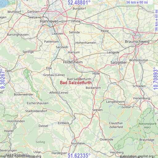
Bad Salzdetfurth GPS coordinates[2]
52° 3' 27.972" North, 10° 0' 20.88" East
| Map corner | latitude | longitude |
|---|---|---|
| Upper-left | 52.48801°, | 9.30267° |
| Center: | 52.05777°, | 10.0058° |
| Lower-right: | 51.62335°, | 10.70893° |
| Map W x H: | 96.1×96.1 km | = 59.7×59.7mi |
| max Lat: | 55.01917° ⇑27.4% North |
| Bad Salzdetfurth: | 52.05777° |
| min Lat: | ⇓72.6% South 47.40724° |
| min Long | Bad Salzdetfurt | max Long |
| 5.92978° | 10.0058° | 14.98853° |
| W 50.1%⇐ | ⇒49.9% E |
Elevation
Elevation of Bad Salzdetfurth is 110 m = 361 ft, and this is 139.1 m = 456 ft below average elevation for this country.
| Max E: |
1256 m = 4121 ft | 66.7% |
| Avg. | 249.1 m = 817 ft | |
| Bad Salzdetfurth | 110 m = 361 ft | |
Min E: |
-5 m = -16 ft | 33.3% |
See also: Germany elevation on elevation.city.
Geographical zone
Bad Salzdetfurth is located in North temperate zone (between Tropic of Cancer and the Arctic Circle). Distance of this North polar circle is 1612.9 km =1002.2 mi to North.| Distance of | km | miles | from Bad Salzdetfurth |
|---|---|---|---|
| North Pole | 4218.8 | 2621.4 | to North |
| Arctic Circle | 1612.9 | 1002.2 | to North |
| Tropic Cancer | 3182.4 | 1977.5 | to South |
| Equator | 5788.3 | 3596.7 | to South |


Nearby cities:
15 places around Bad Salzdetfurth: (largest is in red/bold)
• Adenstedt
8.2 km =5.1 mi,  216°
216°
• Almstedt
4.1 km =2.5 mi,  227°
227°
• Bockenem
10.1 km =6.3 mi,  121°
121°
• Diekholzen
7.3 km =4.5 mi,  305°
305°
• Eberholzen
10.7 km =6.6 mi,  265°
265°
• Harbarnsen
8.7 km =5.4 mi,  197°
197°
• Haverlah
11 km =6.8 mi,  84°
84°
• Hildesheim
11 km =6.8 mi,  340°
340°
• Holle
11 km =6.8 mi,  72°
72°
• Lamspringe
10.8 km =6.7 mi,  178°
178°
• Neuhof
8.8 km =5.5 mi,  159°
159°
• Sehlem
5.4 km =3.4 mi, 202°
• Sibbesse
7.3 km =4.5 mi,  263°
263°
• Westfeld
6.2 km =3.9 mi, 261°
• Woltershausen
9.1 km =5.7 mi, 204°
Sources, notices
• [Note1] Compared only with cities in Germany existing in our database
• [Src1] Map data: © OpenStreetMap contributors (CC-BY-SA)
• [Src2] Other city data from geonames.org with taken over terms of usage.
• [Src3] Geographical zone / Annual Mean Temperature by Robert A. Rohde @ Wikipedia
