Wohldorf-Ohlstedt geodata
Wohldorf-Ohlstedt (Hamburg) is a section of populated place; located in Germany in Europe/Berlin (GMT+2) time zone. With population of 4,450 people, there are 3064 cities with bigger population in this country. Compared to other cities in Germany, 88.5% of cities are located further ↓South; 52.1% of cities are located further ←West and 87.7% of cities have higher elevation than Wohldorf-Ohlstedt. Note1
Administrative division(s):
- Level 1: Hamburg
- Level 3: Hamburg, Freie und Hansestadt
- Level 4: Hamburg, Freie und Hansestadt


Wohldorf-Ohlstedt GPS coordinates[2]
53° 41' 34.152" North, 10° 7' 52.212" East
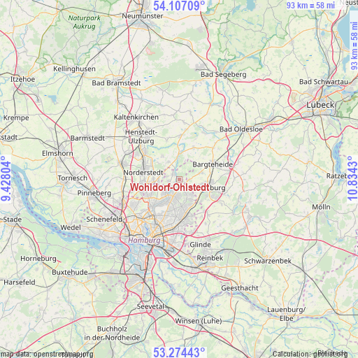
| Map corner | latitude | longitude |
|---|---|---|
| Upper-left | 54.10709°, | 9.42804° |
| Center: | 53.69282°, | 10.13117° |
| Lower-right: | 53.27443°, | 10.8343° |
| Map W x H: | 92.6×92.6 km | = 57.5×57.5mi |
| max Lat: | 55.01917° ⇑11.5% North |
| Wohldorf-Ohlstedt: | 53.69282° |
| min Lat: | ⇓88.5% South 47.40724° |
| min Long | Wohldorf-Ohlste | max Long |
| 5.92978° | 10.13117° | 14.98853° |
| W 52.1%⇐ | ⇒47.9% E |
Elevation
Elevation of Wohldorf-Ohlstedt is 28 m = 92 ft, and this is 221.1 m = 725 ft below average elevation for this country.
| Max E: |
1256 m = 4121 ft | 87.7% |
| Avg. | 249.1 m = 817 ft | |
| Wohldorf-Ohlstedt | 28 m = 92 ft | |
Min E: |
-5 m = -16 ft | 12.3% |
See also: Germany elevation on elevation.city.
Geographical zone
Wohldorf-Ohlstedt is located in North temperate zone (between Tropic of Cancer and the Arctic Circle). Distance of this North polar circle is 1431.1 km =889.2 mi to North.| Distance of | km | miles | from Wohldorf-Ohlstedt |
|---|---|---|---|
| North Pole | 4037 | 2508.5 | to North |
| Arctic Circle | 1431.1 | 889.2 | to North |
| Tropic Cancer | 3364.2 | 2090.4 | to South |
| Equator | 5970.1 | 3709.6 | to South |


Nearby cities:
15 places around Wohldorf-Ohlstedt: (largest is in red/bold)
• Ahrensburg
6.5 km =4 mi,  107°
107°
• Bargfeld-Stegen
9.1 km =5.7 mi,  23°
23°
• Bergstedt
2.4 km =1.5 mi,  186°
186°
• Delingsdorf
7.9 km =4.9 mi,  84°
84°
• Duvenstedt
2.4 km =1.5 mi,  313°
313°
• Farmsen-Berne
9.6 km =6 mi,  184°
184°
• Hummelsbüttel
7.7 km =4.8 mi,  229°
229°
• Jersbek
7.2 km =4.5 mi,  51°
51°
• Kayhude
7.1 km =4.4 mi,  0°
0°
• Langenhorn
8.1 km =5 mi,  248°
248°
• Lemsahl-Mellingstedt
2.3 km =1.4 mi,  262°
262°
• Poppenbüttel
4.8 km =3 mi,  219°
219°
• Sasel
4.5 km =2.8 mi,  196°
196°
• Tangstedt
5.5 km =3.4 mi,  325°
325°
• Wellingsbüttel
6.7 km =4.2 mi,  210°
210°
Sources, notices
• [Note1] Compared only with cities in Germany existing in our database
• [Src1] Map data: © OpenStreetMap contributors (CC-BY-SA)
• [Src2] Other city data from geonames.org with taken over terms of usage.
• [Src3] Geographical zone / Annual Mean Temperature by Robert A. Rohde @ Wikipedia
