Duvenstedt geodata
Duvenstedt (Hamburg) is a populated place; located in Germany in Europe/Berlin (GMT+2) time zone. With population of 6,022 people, there are 2455 cities with bigger population in this country. Compared to other cities in Germany, 88.7% of cities are located further ↓South; 51.8% of cities are located further ←West and 88.6% of cities have higher elevation than Duvenstedt. Note1
Administrative division(s):
- Level 1: Hamburg
- Level 3: Hamburg, Freie und Hansestadt
- Level 4: Hamburg, Freie und Hansestadt


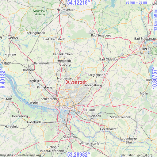
Duvenstedt GPS coordinates[2]
53° 42' 29.016" North, 10° 6' 15.984" East
| Map corner | latitude | longitude |
|---|---|---|
| Upper-left | 54.12218°, | 9.40132° |
| Center: | 53.70806°, | 10.10444° |
| Lower-right: | 53.28982°, | 10.80757° |
| Map W x H: | 92.5×92.5 km | = 57.5×57.5mi |
| max Lat: | 55.01917° ⇑11.3% North |
| Duvenstedt: | 53.70806° |
| min Lat: | ⇓88.7% South 47.40724° |
| min Long | Duvenstedt | max Long |
| 5.92978° | 10.10444° | 14.98853° |
| W 51.8%⇐ | ⇒48.2% E |
Elevation
Elevation of Duvenstedt is 25 m = 82 ft, and this is 224.1 m = 735 ft below average elevation for this country.
| Max E: |
1256 m = 4121 ft | 88.6% |
| Avg. | 249.1 m = 817 ft | |
| Duvenstedt | 25 m = 82 ft | |
Min E: |
-5 m = -16 ft | 11.4% |
See also: Germany elevation on elevation.city.
Geographical zone
Duvenstedt is located in North temperate zone (between Tropic of Cancer and the Arctic Circle). Distance of this North polar circle is 1429.4 km =888.2 mi to North.| Distance of | km | miles | from Duvenstedt |
|---|---|---|---|
| North Pole | 4035.3 | 2507.4 | to North |
| Arctic Circle | 1429.4 | 888.2 | to North |
| Tropic Cancer | 3365.9 | 2091.5 | to South |
| Equator | 5971.8 | 3710.7 | to South |


Nearby cities:
15 places around Duvenstedt: (largest is in red/bold)
• Ahrensburg
8.8 km =5.5 mi,  114°
114°
• Bargfeld-Stegen
8.6 km =5.3 mi,  39°
39°
• Bergstedt
4.4 km =2.7 mi,  160°
160°
• Delingsdorf
9.6 km =6 mi,  95°
95°
• Hummelsbüttel
7.9 km =4.9 mi,  211°
211°
• Jersbek
7.9 km =4.9 mi,  69°
69°
• Kayhude
5.7 km =3.5 mi,  18°
18°
• Langenhorn
7.4 km =4.6 mi,  231°
231°
• Lemsahl-Mellingstedt
2.1 km =1.3 mi,  194°
194°
• Norderstedt
8.5 km =5.3 mi,  253°
253°
• Poppenbüttel
5.6 km =3.5 mi, 193°
• Sasel
6 km =3.7 mi,  175°
175°
• Tangstedt
3.1 km =1.9 mi,  333°
333°
• Wellingsbüttel
7.6 km =4.7 mi, 192°
• Wohldorf-Ohlstedt
2.4 km =1.5 mi,  133°
133°
Sources, notices
• [Note1] Compared only with cities in Germany existing in our database
• [Src1] Map data: © OpenStreetMap contributors (CC-BY-SA)
• [Src2] Other city data from geonames.org with taken over terms of usage.
• [Src3] Geographical zone / Annual Mean Temperature by Robert A. Rohde @ Wikipedia
