Wintersheim geodata
Wintersheim (Rheinland-Pfalz) is a seat of a fourth-order administrative division; located in Germany in Europe/Berlin (GMT+2) time zone. With population of 312 people, there are 10006 cities with bigger population in this country. Compared to other cities in Germany, 69.5% of cities are located further ↑North; 73.1% of cities are located further →East and 53.7% of cities have higher elevation than Wintersheim. Note1
Administrative division(s):
- Level 1: Rheinland-Pfalz
- Level 3: Landkreis Mainz-Bingen
- Level 4: Wintersheim


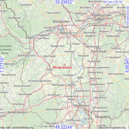
Wintersheim GPS coordinates[2]
49° 46' 42.996" North, 8° 16' 49.008" East
| Map corner | latitude | longitude |
|---|---|---|
| Upper-left | 50.23052°, | 7.57716° |
| Center: | 49.77861°, | 8.28028° |
| Lower-right: | 49.32244°, | 8.98341° |
| Map W x H: | 101×101 km | = 62.8×62.8mi |
| max Lat: | 55.01917° ⇑69.5% North |
| Wintersheim: | 49.77861° |
| min Lat: | ⇓30.5% South 47.40724° |
| min Long | Wintersheim | max Long |
| 5.92978° | 8.28028° | 14.98853° |
| W 26.9%⇐ | ⇒73.1% E |
Elevation
Elevation of Wintersheim is 199 m = 653 ft, and this is 50.1 m = 164 ft below average elevation for this country.
| Max E: |
1256 m = 4121 ft | 53.7% |
| Avg. | 249.1 m = 817 ft | |
| Wintersheim | 199 m = 653 ft | |
Min E: |
-5 m = -16 ft | 46.3% |
See also: Germany elevation on elevation.city.
Geographical zone
Wintersheim is located in North temperate zone (between Tropic of Cancer and the Arctic Circle). Distance of this North polar circle is 1866.3 km =1159.7 mi to North.| Distance of | km | miles | from Wintersheim |
|---|---|---|---|
| North Pole | 4472.2 | 2778.9 | to North |
| Arctic Circle | 1866.3 | 1159.7 | to North |
| Tropic Cancer | 2928.9 | 1819.9 | to South |
| Equator | 5534.9 | 3439.2 | to South |


Nearby cities:
15 places around Wintersheim: (largest is in red/bold)
• Alsheim
4.5 km =2.8 mi,  105°
105°
• Bechtheim
5.7 km =3.5 mi,  171°
171°
• Dalheim
5.5 km =3.4 mi,  11°
11°
• Dittelsheim-Heßloch
5 km =3.1 mi,  218°
218°
• Dolgesheim
2.4 km =1.5 mi,  316°
316°
• Dorn-Dürkheim
1.3 km =0.8 mi,  214°
214°
• Eimsheim
2 km =1.2 mi,  18°
18°
• Frettenheim
3.3 km =2.1 mi,  230°
230°
• Gau-Odernheim
6.2 km =3.9 mi,  276°
276°
• Guntersblum
5.1 km =3.2 mi,  65°
65°
• Hillesheim
1.8 km =1.1 mi,  261°
261°
• Ludwigshöhe
6.2 km =3.9 mi,  47°
47°
• Mettenheim
5.4 km =3.4 mi,  142°
142°
• Uelversheim
3.5 km =2.2 mi, 9°
• Weinolsheim
4.2 km =2.6 mi,  352°
352°
Sources, notices
• [Note1] Compared only with cities in Germany existing in our database
• [Src1] Map data: © OpenStreetMap contributors (CC-BY-SA)
• [Src2] Other city data from geonames.org with taken over terms of usage.
• [Src3] Geographical zone / Annual Mean Temperature by Robert A. Rohde @ Wikipedia
