Ludwigshöhe geodata
Ludwigshöhe (Rheinland-Pfalz) is a seat of a fourth-order administrative division; located in Germany in Europe/Berlin (GMT+2) time zone. In our database, there are 11009 cities with bigger population. Compared to other cities in Germany, 68.6% of cities are located further ↑North; 72.5% of cities are located further →East and 69.7% of cities have higher elevation than Ludwigshöhe. Note1
Administrative division(s):
- Level 1: Rheinland-Pfalz
- Level 3: Landkreis Mainz-Bingen
- Level 4: Ludwigshöhe


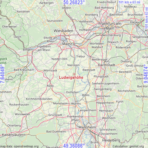
Ludwigshöhe GPS coordinates[2]
49° 49' 0.012" North, 8° 20' 36.996" East
| Map corner | latitude | longitude |
|---|---|---|
| Upper-left | 50.26823°, | 7.64049° |
| Center: | 49.81667°, | 8.34361° |
| Lower-right: | 49.36086°, | 9.04674° |
| Map W x H: | 100.9×100.9 km | = 62.7×62.7mi |
| max Lat: | 55.01917° ⇑68.6% North |
| Ludwigshöhe: | 49.81667° |
| min Lat: | ⇓31.4% South 47.40724° |
| min Long | Ludwigshöhe | max Long |
| 5.92978° | 8.34361° | 14.98853° |
| W 27.5%⇐ | ⇒72.5% E |
Elevation
Elevation of Ludwigshöhe is 93 m = 305 ft, and this is 156.1 m = 512 ft below average elevation for this country.
| Max E: |
1256 m = 4121 ft | 69.7% |
| Avg. | 249.1 m = 817 ft | |
| Ludwigshöhe | 93 m = 305 ft | |
Min E: |
-5 m = -16 ft | 30.3% |
See also: Germany elevation on elevation.city.
Geographical zone
Ludwigshöhe is located in North temperate zone (between Tropic of Cancer and the Arctic Circle). Distance of this North polar circle is 1862.1 km =1157.1 mi to North.| Distance of | km | miles | from Ludwigshöhe |
|---|---|---|---|
| North Pole | 4468 | 2776.3 | to North |
| Arctic Circle | 1862.1 | 1157.1 | to North |
| Tropic Cancer | 2933.2 | 1822.6 | to South |
| Equator | 5539.1 | 3441.8 | to South |


Nearby cities:
15 places around Ludwigshöhe: (largest is in red/bold)
• Alsheim
5.4 km =3.4 mi,  182°
182°
• Dalheim
3.6 km =2.2 mi,  287°
287°
• Dexheim
3.9 km =2.4 mi,  330°
330°
• Dienheim
2.3 km =1.4 mi,  10°
10°
• Dolgesheim
6.7 km =4.2 mi,  248°
248°
• Dorn-Dürkheim
7.5 km =4.7 mi,  224°
224°
• Eimsheim
4.5 km =2.8 mi,  239°
239°
• Friesenheim
6.6 km =4.1 mi, 289°
• Gimbsheim
4.9 km =3 mi,  152°
152°
• Guntersblum
2.1 km =1.3 mi, 176°
• Nierstein
6 km =3.7 mi,  355°
355°
• Oppenheim
4.4 km =2.7 mi,  15°
15°
• Uelversheim
4 km =2.5 mi,  259°
259°
• Weinolsheim
5.1 km =3.2 mi,  268°
268°
• Wintersheim
6.2 km =3.9 mi,  227°
227°
Sources, notices
• [Note1] Compared only with cities in Germany existing in our database
• [Src1] Map data: © OpenStreetMap contributors (CC-BY-SA)
• [Src2] Other city data from geonames.org with taken over terms of usage.
• [Src3] Geographical zone / Annual Mean Temperature by Robert A. Rohde @ Wikipedia
