Wildsteig geodata
Wildsteig (Bavaria) is a seat of a fourth-order administrative division; located in Germany in Europe/Berlin (GMT+2) time zone. With population of 1,245 people, there are 6461 cities with bigger population in this country. Compared to other cities in Germany, 98.7% of cities are located further ↑North; 66.1% of cities are located further ←West and 99.6% of cities have lower elevation than Wildsteig. Note1
Administrative division(s):
- Level 1: Bavaria
- Level 2: Upper Bavaria
- Level 3: Landkreis Weilheim-Schongau
- Level 4: Wildsteig


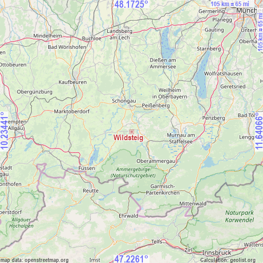
Wildsteig GPS coordinates[2]
47° 42' 5.22" North, 10° 56' 15.108" East
| Map corner | latitude | longitude |
|---|---|---|
| Upper-left | 48.1725°, | 10.23441° |
| Center: | 47.70145°, | 10.93753° |
| Lower-right: | 47.2261°, | 11.64066° |
| Map W x H: | 105.2×105.2 km | = 65.4×65.4mi |
| max Lat: | 55.01917° ⇑98.7% North |
| Wildsteig: | 47.70145° |
| min Lat: | ⇓1.3% South 47.40724° |
| min Long | Wildsteig | max Long |
| 5.92978° | 10.93753° | 14.98853° |
| W 66.1%⇐ | ⇒33.9% E |
Elevation
Elevation of Wildsteig is 866 m = 2841 ft, and this is 616.9 m = 2024 ft above average elevation for this country.
| Max E: |
1256 m = 4121 ft | 0.40000000000001% |
| Wildsteig | 866 m 2841 ft | |
| Avg. | 249.1 m = 817 ft | |
Min E: |
-5 m = -16 ft | 99.6% |
See also: Germany elevation on elevation.city.
Geographical zone
Wildsteig is located in North temperate zone (between Tropic of Cancer and the Arctic Circle). Distance of this North polar circle is 2097.3 km =1303.2 mi to North.| Distance of | km | miles | from Wildsteig |
|---|---|---|---|
| North Pole | 4703.2 | 2922.4 | to North |
| Arctic Circle | 2097.3 | 1303.2 | to North |
| Tropic Cancer | 2698 | 1676.5 | to South |
| Equator | 5303.9 | 3295.7 | to South |


Nearby cities:
15 places around Wildsteig: (largest is in red/bold)
• Altenstadt
14.4 km =8.9 mi,  340°
340°
• Bad Kohlgrub
9.3 km =5.8 mi,  114°
114°
• Bernbeuren
12.6 km =7.8 mi,  288°
288°
• Burggen
12.3 km =7.6 mi,  313°
313°
• Böbing
7.1 km =4.4 mi,  32°
32°
• Halblech
11.7 km =7.3 mi,  228°
228°
• Hohenpeißenberg
11.9 km =7.4 mi,  23°
23°
• Lechbruck
10.7 km =6.6 mi,  270°
270°
• Peiting
10.5 km =6.5 mi,  356°
356°
• Prem
10.5 km =6.5 mi,  258°
258°
• Rottenbuch
4.2 km =2.6 mi, 31°
• Saulgrub
7.6 km =4.7 mi,  120°
120°
• Schongau
12.7 km =7.9 mi,  346°
346°
• Steingaden
5.3 km =3.3 mi, 268°
• Unterammergau
11.6 km =7.2 mi,  144°
144°
Sources, notices
• [Note1] Compared only with cities in Germany existing in our database
• [Src1] Map data: © OpenStreetMap contributors (CC-BY-SA)
• [Src2] Other city data from geonames.org with taken over terms of usage.
• [Src3] Geographical zone / Annual Mean Temperature by Robert A. Rohde @ Wikipedia
