Wiegendorf geodata
Wiegendorf (Thuringia) is a seat of a fourth-order administrative division; located in Germany in Europe/Berlin (GMT+2) time zone. With population of 416 people, there are 9644 cities with bigger population in this country. Compared to other cities in Germany, 57.8% of cities are located further ↓South; 73.2% of cities are located further ←West and 56.5% of cities have lower elevation than Wiegendorf. Note1


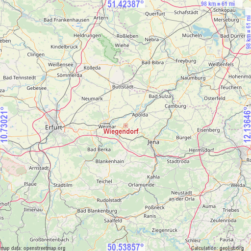
Wiegendorf GPS coordinates[2]
50° 58' 59.988" North, 11° 25' 59.988" East
| Map corner | latitude | longitude |
|---|---|---|
| Upper-left | 51.42387°, | 10.73021° |
| Center: | 50.98333°, | 11.43333° |
| Lower-right: | 50.53857°, | 12.13646° |
| Map W x H: | 98.4×98.4 km | = 61.1×61.1mi |
| max Lat: | 55.01917° ⇑42.2% North |
| Wiegendorf: | 50.98333° |
| min Lat: | ⇓57.8% South 47.40724° |
| min Long | Wiegendorf | max Long |
| 5.92978° | 11.43333° | 14.98853° |
| W 73.2%⇐ | ⇒26.8% E |
Elevation
Elevation of Wiegendorf is 269 m = 883 ft, and this is 19.9 m = 65 ft above average elevation for this country.
| Max E: |
1256 m = 4121 ft | 43.5% |
| Wiegendorf | 269 m 883 ft | |
| Avg. | 249.1 m = 817 ft | |
Min E: |
-5 m = -16 ft | 56.5% |
See also: Germany elevation on elevation.city.
Geographical zone
Wiegendorf is located in North temperate zone (between Tropic of Cancer and the Arctic Circle). Distance of this North polar circle is 1732.4 km =1076.5 mi to North.| Distance of | km | miles | from Wiegendorf |
|---|---|---|---|
| North Pole | 4338.2 | 2695.6 | to North |
| Arctic Circle | 1732.4 | 1076.5 | to North |
| Tropic Cancer | 3062.9 | 1903.2 | to South |
| Equator | 5668.8 | 3522.4 | to South |


Nearby cities:
15 places around Wiegendorf: (largest is in red/bold)
• Apolda
7.5 km =4.7 mi,  50°
50°
• Frankendorf
2.2 km =1.4 mi,  147°
147°
• Goldbach
6.9 km =4.3 mi,  359°
359°
• Großschwabhausen
6.6 km =4.1 mi, 147°
• Hammerstedt
3.6 km =2.2 mi,  155°
155°
• Kapellendorf
2.7 km =1.7 mi,  111°
111°
• Kleinschwabhausen
6.1 km =3.8 mi, 161°
• Kromsdorf
5 km =3.1 mi,  291°
291°
• Lehnstedt
5.6 km =3.5 mi,  180°
180°
• Mellingen
5.3 km =3.3 mi,  208°
208°
• Niederroßla
6.6 km =4.1 mi,  32°
32°
• Oßmanstedt
3.9 km =2.4 mi,  353°
353°
• Umpferstedt
1.2 km =0.7 mi,  270°
270°
• Weimar
7.3 km =4.5 mi, 267°
• Wohlsborn
7.3 km =4.5 mi,  320°
320°
Sources, notices
• [Note1] Compared only with cities in Germany existing in our database
• [Src1] Map data: © OpenStreetMap contributors (CC-BY-SA)
• [Src2] Other city data from geonames.org with taken over terms of usage.
• [Src3] Geographical zone / Annual Mean Temperature by Robert A. Rohde @ Wikipedia
