Wennbüttel geodata
Wennbüttel (Schleswig-Holstein) is a seat of a fourth-order administrative division; located in Germany in Europe/Berlin (GMT+2) time zone. With population of 76 people, there are 10904 cities with bigger population in this country. Compared to other cities in Germany, 94.2% of cities are located further ↓South; 60.3% of cities are located further →East and 99.1% of cities have higher elevation than Wennbüttel. Note1
Administrative division(s):
- Level 1: Schleswig-Holstein
- Level 3: Kreis Dithmarschen
- Level 4: Wennbüttel


Wennbüttel GPS coordinates[2]
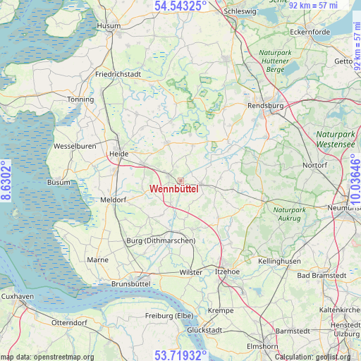
54° 7' 59.988" North, 9° 19' 59.988" East
| Map corner | latitude | longitude |
|---|---|---|
| Upper-left | 54.54325°, | 8.6302° |
| Center: | 54.13333°, | 9.33333° |
| Lower-right: | 53.71932°, | 10.03646° |
| Map W x H: | 91.6×91.6 km | = 56.9×56.9mi |
| max Lat: | 55.01917° ⇑5.8% North |
| Wennbüttel: | 54.13333° |
| min Lat: | ⇓94.2% South 47.40724° |
| min Long | Wennbüttel | max Long |
| 5.92978° | 9.33333° | 14.98853° |
| W 39.7%⇐ | ⇒60.3% E |
Elevation
Elevation of Wennbüttel is 0 m = 0 ft, and this is 249.1 m = 817 ft below average elevation for this country.
| Max E: |
1256 m = 4121 ft | 99.1% |
| Avg. | 249.1 m = 817 ft | |
| Wennbüttel | 0 m = 0 ft | |
Min E: |
-5 m = -16 ft | 0.9% |
See also: Germany elevation on elevation.city.
Geographical zone
Wennbüttel is located in North temperate zone (between Tropic of Cancer and the Arctic Circle). Distance of this North polar circle is 1382.1 km =858.8 mi to North.| Distance of | km | miles | from Wennbüttel |
|---|---|---|---|
| North Pole | 3988 | 2478 | to North |
| Arctic Circle | 1382.1 | 858.8 | to North |
| Tropic Cancer | 3413.1 | 2120.8 | to South |
| Equator | 6019.1 | 3740.1 | to South |


Nearby cities:
15 places around Wennbüttel: (largest is in red/bold)
• Albersdorf
3.7 km =2.3 mi,  299°
299°
• Arkebek
6.6 km =4.1 mi, 304°
• Beldorf
1.1 km =0.7 mi,  90°
90°
• Bendorf
6.4 km =4 mi,  149°
149°
• Bornholt
3.7 km =2.3 mi,  180°
180°
• Bunsoh
3.6 km =2.2 mi,  345°
345°
• Hanerau-Hademarschen
5.4 km =3.4 mi, 90°
• Immenstedt
6 km =3.7 mi,  338°
338°
• Offenbüttel
4.4 km =2.7 mi,  18°
18°
• Osterrade
7.5 km =4.7 mi,  8°
8°
• Schafstedt
6 km =3.7 mi,  201°
201°
• Schrum
7.8 km =4.8 mi,  315°
315°
• Steenfeld
2.9 km =1.8 mi,  49°
49°
• Tensbüttel-Röst
7.5 km =4.7 mi,  240°
240°
• Thaden
7 km =4.3 mi,  120°
120°
Sources, notices
• [Note1] Compared only with cities in Germany existing in our database
• [Src1] Map data: © OpenStreetMap contributors (CC-BY-SA)
• [Src2] Other city data from geonames.org with taken over terms of usage.
• [Src3] Geographical zone / Annual Mean Temperature by Robert A. Rohde @ Wikipedia
