Bendorf geodata
Bendorf (Schleswig-Holstein) is a seat of a fourth-order administrative division; located in Germany in Europe/Berlin (GMT+2) time zone. With population of 506 people, there are 9350 cities with bigger population in this country. Compared to other cities in Germany, 93.7% of cities are located further ↓South; 59.6% of cities are located further →East and 91.6% of cities have higher elevation than Bendorf. Note1
Administrative division(s):
- Level 1: Schleswig-Holstein
- Level 3: Kreis Rendsburg-Eckernförde
- Level 4: Bendorf


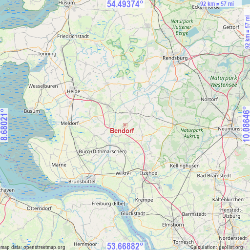
Bendorf GPS coordinates[2]
54° 4' 59.988" North, 9° 22' 59.988" East
| Map corner | latitude | longitude |
|---|---|---|
| Upper-left | 54.49374°, | 8.68021° |
| Center: | 54.08333°, | 9.38333° |
| Lower-right: | 53.66882°, | 10.08646° |
| Map W x H: | 91.7×91.7 km | = 57×57mi |
| max Lat: | 55.01917° ⇑6.3% North |
| Bendorf: | 54.08333° |
| min Lat: | ⇓93.7% South 47.40724° |
| min Long | Bendorf | max Long |
| 5.92978° | 9.38333° | 14.98853° |
| W 40.4%⇐ | ⇒59.6% E |
Elevation
Elevation of Bendorf is 17 m = 56 ft, and this is 232.1 m = 761 ft below average elevation for this country.
| Max E: |
1256 m = 4121 ft | 91.6% |
| Avg. | 249.1 m = 817 ft | |
| Bendorf | 17 m = 56 ft | |
Min E: |
-5 m = -16 ft | 8.4% |
See also: Germany elevation on elevation.city.
Geographical zone
Bendorf is located in North temperate zone (between Tropic of Cancer and the Arctic Circle). Distance of this North polar circle is 1387.7 km =862.3 mi to North.| Distance of | km | miles | from Bendorf |
|---|---|---|---|
| North Pole | 3993.6 | 2481.5 | to North |
| Arctic Circle | 1387.7 | 862.3 | to North |
| Tropic Cancer | 3407.6 | 2117.4 | to South |
| Equator | 6013.5 | 3736.6 | to South |


Nearby cities:
15 places around Bendorf: (largest is in red/bold)
• Aasbüttel
3.8 km =2.4 mi,  119°
119°
• Beldorf
6 km =3.7 mi,  338°
338°
• Besdorf
4 km =2.5 mi,  202°
202°
• Bokelrehm
5 km =3.1 mi,  177°
177°
• Bokhorst
2.1 km =1.3 mi,  149°
149°
• Bornholt
3.8 km =2.4 mi,  299°
299°
• Gokels
6.6 km =4.1 mi,  55°
55°
• Gribbohm
6.6 km =4.1 mi, 200°
• Hanerau-Hademarschen
6 km =3.7 mi,  21°
21°
• Holstenniendorf
5.2 km =3.2 mi,  206°
206°
• Nienbüttel
6.3 km =3.9 mi,  161°
161°
• Schafstedt
5.4 km =3.4 mi,  270°
270°
• Thaden
3.4 km =2.1 mi,  53°
53°
• Warringholz
5.4 km =3.4 mi,  90°
90°
• Wennbüttel
6.4 km =4 mi,  329°
329°
Sources, notices
• [Note1] Compared only with cities in Germany existing in our database
• [Src1] Map data: © OpenStreetMap contributors (CC-BY-SA)
• [Src2] Other city data from geonames.org with taken over terms of usage.
• [Src3] Geographical zone / Annual Mean Temperature by Robert A. Rohde @ Wikipedia
