Schafstedt geodata
Schafstedt (Schleswig-Holstein) is a seat of a fourth-order administrative division; located in Germany in Europe/Berlin (GMT+2) time zone. In our database, there are 11009 cities with bigger population. Compared to other cities in Germany, 93.7% of cities are located further ↓South; 60.8% of cities are located further →East and 92% of cities have higher elevation than Schafstedt. Note1
Administrative division(s):
- Level 1: Schleswig-Holstein
- Level 3: Kreis Dithmarschen
- Level 4: Schafstedt


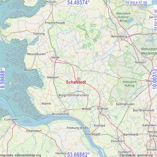
Schafstedt GPS coordinates[2]
54° 4' 59.988" North, 9° 18' 0" East
| Map corner | latitude | longitude |
|---|---|---|
| Upper-left | 54.49374°, | 8.59688° |
| Center: | 54.08333°, | 9.3° |
| Lower-right: | 53.66882°, | 10.00313° |
| Map W x H: | 91.7×91.7 km | = 57×57mi |
| max Lat: | 55.01917° ⇑6.3% North |
| Schafstedt: | 54.08333° |
| min Lat: | ⇓93.7% South 47.40724° |
| min Long | Schafstedt | max Long |
| 5.92978° | 9.3° | 14.98853° |
| W 39.2%⇐ | ⇒60.8% E |
Elevation
Elevation of Schafstedt is 16 m = 52 ft, and this is 233.1 m = 765 ft below average elevation for this country.
| Max E: |
1256 m = 4121 ft | 92% |
| Avg. | 249.1 m = 817 ft | |
| Schafstedt | 16 m = 52 ft | |
Min E: |
-5 m = -16 ft | 8% |
See also: Germany elevation on elevation.city.
Geographical zone
Schafstedt is located in North temperate zone (between Tropic of Cancer and the Arctic Circle). Distance of this North polar circle is 1387.7 km =862.3 mi to North.| Distance of | km | miles | from Schafstedt |
|---|---|---|---|
| North Pole | 3993.6 | 2481.5 | to North |
| Arctic Circle | 1387.7 | 862.3 | to North |
| Tropic Cancer | 3407.6 | 2117.4 | to South |
| Equator | 6013.5 | 3736.6 | to South |


Nearby cities:
15 places around Schafstedt: (largest is in red/bold)
• Albersdorf
7.5 km =4.7 mi,  351°
351°
• Beldorf
6.4 km =4 mi,  30°
30°
• Bendorf
5.4 km =3.4 mi,  90°
90°
• Besdorf
5.4 km =3.4 mi,  133°
133°
• Bokelrehm
7.5 km =4.7 mi, 131°
• Bokhorst
6.8 km =4.2 mi,  105°
105°
• Bornholt
2.9 km =1.8 mi,  49°
49°
• Eggstedt
4.3 km =2.7 mi,  210°
210°
• Gribbohm
6.9 km =4.3 mi,  153°
153°
• Hochdonn
6.5 km =4 mi,  193°
193°
• Holstenniendorf
5.6 km =3.5 mi, 145°
• Krumstedt
7.8 km =4.8 mi,  256°
256°
• Süderhastedt
7.1 km =4.4 mi,  237°
237°
• Tensbüttel-Röst
4.7 km =2.9 mi,  293°
293°
• Wennbüttel
6 km =3.7 mi,  21°
21°
Sources, notices
• [Note1] Compared only with cities in Germany existing in our database
• [Src1] Map data: © OpenStreetMap contributors (CC-BY-SA)
• [Src2] Other city data from geonames.org with taken over terms of usage.
• [Src3] Geographical zone / Annual Mean Temperature by Robert A. Rohde @ Wikipedia
