Wahlhausen geodata
Wahlhausen (Thuringia) is a seat of a fourth-order administrative division; located in Germany in Europe/Berlin (GMT+2) time zone. With population of 356 people, there are 9845 cities with bigger population in this country. Compared to other cities in Germany, 63.2% of cities are located further ↓South; 50.3% of cities are located further →East and 55.5% of cities have higher elevation than Wahlhausen. Note1


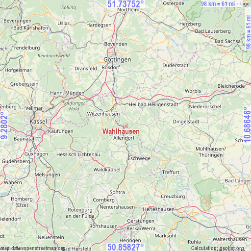
Wahlhausen GPS coordinates[2]
51° 18' 0" North, 9° 58' 59.988" East
| Map corner | latitude | longitude |
|---|---|---|
| Upper-left | 51.73752°, | 9.2802° |
| Center: | 51.3°, | 9.98333° |
| Lower-right: | 50.85827°, | 10.68646° |
| Map W x H: | 97.8×97.8 km | = 60.8×60.8mi |
| max Lat: | 55.01917° ⇑36.8% North |
| Wahlhausen: | 51.3° |
| min Lat: | ⇓63.2% South 47.40724° |
| min Long | Wahlhausen | max Long |
| 5.92978° | 9.98333° | 14.98853° |
| W 49.7%⇐ | ⇒50.3% E |
Elevation
Elevation of Wahlhausen is 185 m = 607 ft, and this is 64.1 m = 210 ft below average elevation for this country.
| Max E: |
1256 m = 4121 ft | 55.5% |
| Avg. | 249.1 m = 817 ft | |
| Wahlhausen | 185 m = 607 ft | |
Min E: |
-5 m = -16 ft | 44.5% |
See also: Germany elevation on elevation.city.
Geographical zone
Wahlhausen is located in North temperate zone (between Tropic of Cancer and the Arctic Circle). Distance of this North polar circle is 1697.1 km =1054.5 mi to North.| Distance of | km | miles | from Wahlhausen |
|---|---|---|---|
| North Pole | 4303 | 2673.8 | to North |
| Arctic Circle | 1697.1 | 1054.5 | to North |
| Tropic Cancer | 3098.1 | 1925.1 | to South |
| Equator | 5704 | 3544.3 | to South |


Nearby cities:
15 places around Wahlhausen: (largest is in red/bold)
• Bad Sooden-Allendorf
3.3 km =2.1 mi,  190°
190°
• Birkenfelde
6 km =3.7 mi,  22°
22°
• Bornhagen
4.4 km =2.7 mi,  327°
327°
• Dieterode
8.1 km =5 mi,  90°
90°
• Eichstruth
7 km =4.3 mi, 90°
• Fretterode
2.2 km =1.4 mi,  32°
32°
• Gerbershausen
3.7 km =2.3 mi,  0°
0°
• Lenterode
6.9 km =4.3 mi,  57°
57°
• Lindewerra
3 km =1.9 mi,  308°
308°
• Mackenrode
5.8 km =3.6 mi, 90°
• Röhrig
5.1 km =3.2 mi,  43°
43°
• Schönhagen
5.1 km =3.2 mi, 31°
• Thalwenden
7.2 km =4.5 mi, 39°
• Volkerode
6.9 km =4.3 mi,  122°
122°
• Wüstheuterode
5.9 km =3.7 mi, 63°
Sources, notices
• [Note1] Compared only with cities in Germany existing in our database
• [Src1] Map data: © OpenStreetMap contributors (CC-BY-SA)
• [Src2] Other city data from geonames.org with taken over terms of usage.
• [Src3] Geographical zone / Annual Mean Temperature by Robert A. Rohde @ Wikipedia
