Veitsrodt geodata
Veitsrodt (Rheinland-Pfalz) is a seat of a fourth-order administrative division; located in Germany in Europe/Berlin (GMT+2) time zone. With population of 727 people, there are 8206 cities with bigger population in this country. Compared to other cities in Germany, 70% of cities are located further ↑North; 89.9% of cities are located further →East and 82.8% of cities have lower elevation than Veitsrodt. Note1
Administrative division(s):
- Level 1: Rheinland-Pfalz
- Level 3: Landkreis Birkenfeld
- Level 4: Veitsrodt


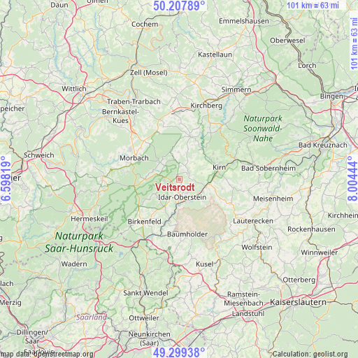
Veitsrodt GPS coordinates[2]
49° 45' 20.736" North, 7° 18' 4.716" East
| Map corner | latitude | longitude |
|---|---|---|
| Upper-left | 50.20789°, | 6.59819° |
| Center: | 49.75576°, | 7.30131° |
| Lower-right: | 49.29938°, | 8.00444° |
| Map W x H: | 101×101 km | = 62.8×62.8mi |
| max Lat: | 55.01917° ⇑70% North |
| Veitsrodt: | 49.75576° |
| min Lat: | ⇓30% South 47.40724° |
| min Long | Veitsrodt | max Long |
| 5.92978° | 7.30131° | 14.98853° |
| W 10.1%⇐ | ⇒89.9% E |
Elevation
Elevation of Veitsrodt is 452 m = 1483 ft, and this is 202.9 m = 666 ft above average elevation for this country.
| Max E: |
1256 m = 4121 ft | 17.2% |
| Veitsrodt | 452 m 1483 ft | |
| Avg. | 249.1 m = 817 ft | |
Min E: |
-5 m = -16 ft | 82.8% |
See also: Germany elevation on elevation.city.
Geographical zone
Veitsrodt is located in North temperate zone (between Tropic of Cancer and the Arctic Circle). Distance of this North polar circle is 1868.9 km =1161.3 mi to North.| Distance of | km | miles | from Veitsrodt |
|---|---|---|---|
| North Pole | 4474.7 | 2780.4 | to North |
| Arctic Circle | 1868.9 | 1161.3 | to North |
| Tropic Cancer | 2926.4 | 1818.4 | to South |
| Equator | 5532.3 | 3437.6 | to South |


Nearby cities:
15 places around Veitsrodt: (largest is in red/bold)
• Breitenthal
5.4 km =3.4 mi,  25°
25°
• Gerach
2.4 km =1.5 mi,  105°
105°
• Herborn
1.2 km =0.7 mi,  355°
355°
• Herrstein
3.8 km =2.4 mi,  36°
36°
• Hettenrodt
3.9 km =2.4 mi,  243°
243°
• Hintertiefenbach
4.3 km =2.7 mi,  125°
125°
• Idar-Oberstein
4.6 km =2.9 mi,  174°
174°
• Kempfeld
5.5 km =3.4 mi,  313°
313°
• Kirschweiler
3.7 km =2.3 mi,  260°
260°
• Mörschied
3.6 km =2.2 mi,  3°
3°
• Niederwörresbach
2.6 km =1.6 mi,  62°
62°
• Oberwörresbach
3.3 km =2.1 mi,  19°
19°
• Rötsweiler-Nockenthal
5 km =3.1 mi,  209°
209°
• Siesbach
5.5 km =3.4 mi, 242°
• Vollmersbach
2.7 km =1.7 mi,  156°
156°
Sources, notices
• [Note1] Compared only with cities in Germany existing in our database
• [Src1] Map data: © OpenStreetMap contributors (CC-BY-SA)
• [Src2] Other city data from geonames.org with taken over terms of usage.
• [Src3] Geographical zone / Annual Mean Temperature by Robert A. Rohde @ Wikipedia
