Hintertiefenbach geodata
Hintertiefenbach (Rheinland-Pfalz) is a seat of a fourth-order administrative division; located in Germany in Europe/Berlin (GMT+2) time zone. With population of 427 people, there are 9611 cities with bigger population in this country. Compared to other cities in Germany, 70.6% of cities are located further ↑North; 89.3% of cities are located further →East and 79.5% of cities have lower elevation than Hintertiefenbach. Note1
Administrative division(s):
- Level 1: Rheinland-Pfalz
- Level 3: Landkreis Birkenfeld
- Level 4: Hintertiefenbach


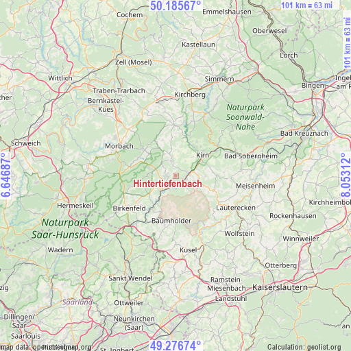
Hintertiefenbach GPS coordinates[2]
49° 43' 59.988" North, 7° 21' 0" East
| Map corner | latitude | longitude |
|---|---|---|
| Upper-left | 50.18567°, | 6.64687° |
| Center: | 49.73333°, | 7.35° |
| Lower-right: | 49.27674°, | 8.05312° |
| Map W x H: | 101.1×101.1 km | = 62.8×62.8mi |
| max Lat: | 55.01917° ⇑70.6% North |
| Hintertiefenbach: | 49.73333° |
| min Lat: | ⇓29.4% South 47.40724° |
| min Long | Hintertiefenbac | max Long |
| 5.92978° | 7.35° | 14.98853° |
| W 10.7%⇐ | ⇒89.3% E |
Elevation
Elevation of Hintertiefenbach is 430 m = 1411 ft, and this is 180.9 m = 594 ft above average elevation for this country.
| Max E: |
1256 m = 4121 ft | 20.5% |
| Hintertiefenbach | 430 m 1411 ft | |
| Avg. | 249.1 m = 817 ft | |
Min E: |
-5 m = -16 ft | 79.5% |
See also: Germany elevation on elevation.city.
Geographical zone
Hintertiefenbach is located in North temperate zone (between Tropic of Cancer and the Arctic Circle). Distance of this North polar circle is 1871.3 km =1162.8 mi to North.| Distance of | km | miles | from Hintertiefenbach |
|---|---|---|---|
| North Pole | 4477.2 | 2782 | to North |
| Arctic Circle | 1871.3 | 1162.8 | to North |
| Tropic Cancer | 2923.9 | 1816.8 | to South |
| Equator | 5529.8 | 3436.1 | to South |


Nearby cities:
15 places around Hintertiefenbach: (largest is in red/bold)
• Dickesbach
5.1 km =3.2 mi,  111°
111°
• Fischbach
3.6 km =2.2 mi,  90°
90°
• Gerach
2.2 km =1.4 mi,  327°
327°
• Herborn
5.2 km =3.2 mi,  315°
315°
• Herrstein
5.7 km =3.5 mi,  347°
347°
• Hettenrodt
7 km =4.3 mi,  276°
276°
• Idar-Oberstein
3.7 km =2.3 mi,  235°
235°
• Mittelreidenbach
6.6 km =4.1 mi,  96°
96°
• Mörschied
6.9 km =4.3 mi, 331°
• Niederwörresbach
3.9 km =2.4 mi,  342°
342°
• Oberbrombach
7 km =4.3 mi, 238°
• Oberwörresbach
6.1 km =3.8 mi, 336°
• Rötsweiler-Nockenthal
6.3 km =3.9 mi,  252°
252°
• Veitsrodt
4.3 km =2.7 mi,  305°
305°
• Vollmersbach
2.4 km =1.5 mi,  270°
270°
Sources, notices
• [Note1] Compared only with cities in Germany existing in our database
• [Src1] Map data: © OpenStreetMap contributors (CC-BY-SA)
• [Src2] Other city data from geonames.org with taken over terms of usage.
• [Src3] Geographical zone / Annual Mean Temperature by Robert A. Rohde @ Wikipedia
