Vatterode geodata
Vatterode (Saxony-Anhalt) is a populated place; located in Germany in Europe/Berlin (GMT+2) time zone. With population of 709 people, there are 8274 cities with bigger population in this country. Compared to other cities in Germany, 67.6% of cities are located further ↓South; 73.2% of cities are located further ←West and 55% of cities have higher elevation than Vatterode. Note1


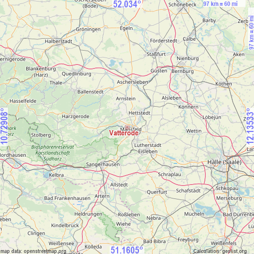
Vatterode GPS coordinates[2]
51° 35' 57.66" North, 11° 25' 55.92" East
| Map corner | latitude | longitude |
|---|---|---|
| Upper-left | 52.034°, | 10.72908° |
| Center: | 51.59935°, | 11.4322° |
| Lower-right: | 51.1605°, | 12.13533° |
| Map W x H: | 97.1×97.1 km | = 60.3×60.3mi |
| max Lat: | 55.01917° ⇑32.4% North |
| Vatterode: | 51.59935° |
| min Lat: | ⇓67.6% South 47.40724° |
| min Long | Vatterode | max Long |
| 5.92978° | 11.4322° | 14.98853° |
| W 73.2%⇐ | ⇒26.8% E |
Elevation
Elevation of Vatterode is 188 m = 617 ft, and this is 61.1 m = 200 ft below average elevation for this country.
| Max E: |
1256 m = 4121 ft | 55% |
| Avg. | 249.1 m = 817 ft | |
| Vatterode | 188 m = 617 ft | |
Min E: |
-5 m = -16 ft | 45% |
See also: Germany elevation on elevation.city.
Geographical zone
Vatterode is located in North temperate zone (between Tropic of Cancer and the Arctic Circle). Distance of this North polar circle is 1663.9 km =1033.9 mi to North.| Distance of | km | miles | from Vatterode |
|---|---|---|---|
| North Pole | 4269.8 | 2653.1 | to North |
| Arctic Circle | 1663.9 | 1033.9 | to North |
| Tropic Cancer | 3131.4 | 1945.8 | to South |
| Equator | 5737.3 | 3565 | to South |


Nearby cities:
15 places around Vatterode: (largest is in red/bold)
• Ahlsdorf
6.4 km =4 mi,  158°
158°
• Alterode
9.1 km =5.7 mi,  338°
338°
• Annarode
5.8 km =3.6 mi,  200°
200°
• Benndorf
5.3 km =3.3 mi,  127°
127°
• Bräunrode
5.1 km =3.2 mi, 338°
• Großörner
4.4 km =2.7 mi,  66°
66°
• Helbra
7.2 km =4.5 mi,  139°
139°
• Hergisdorf
8.1 km =5 mi,  154°
154°
• Hettstedt
7.9 km =4.9 mi,  44°
44°
• Klostermansfeld
5 km =3.1 mi,  110°
110°
• Mansfeld
1.6 km =1 mi,  119°
119°
• Siebigerode
3.9 km =2.4 mi,  183°
183°
• Siersleben
7.7 km =4.8 mi,  86°
86°
• Sylda
8.8 km =5.5 mi,  357°
357°
• Walbeck
7.8 km =4.8 mi,  19°
19°
Sources, notices
• [Note1] Compared only with cities in Germany existing in our database
• [Src1] Map data: © OpenStreetMap contributors (CC-BY-SA)
• [Src2] Other city data from geonames.org with taken over terms of usage.
• [Src3] Geographical zone / Annual Mean Temperature by Robert A. Rohde @ Wikipedia
