Unterthingau geodata
Unterthingau (Bavaria) is a populated place; located in Germany in Europe/Berlin (GMT+2) time zone. With population of 2,747 people, there are 4198 cities with bigger population in this country. Compared to other cities in Germany, 98% of cities are located further ↑North; 59% of cities are located further ←West and 98.9% of cities have lower elevation than Unterthingau. Note1
Administrative division(s):
- Level 1: Bavaria
- Level 2: Swabia
- Level 3: Landkreis Ostallgäu
- Level 4: Unterthingau, Markt


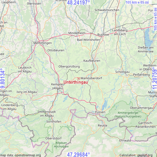
Unterthingau GPS coordinates[2]
47° 46' 17.58" North, 10° 30' 16.056" East
| Map corner | latitude | longitude |
|---|---|---|
| Upper-left | 48.24197°, | 9.80134° |
| Center: | 47.77155°, | 10.50446° |
| Lower-right: | 47.29684°, | 11.20759° |
| Map W x H: | 105.1×105.1 km | = 65.3×65.3mi |
| max Lat: | 55.01917° ⇑98% North |
| Unterthingau: | 47.77155° |
| min Lat: | ⇓2% South 47.40724° |
| min Long | Unterthingau | max Long |
| 5.92978° | 10.50446° | 14.98853° |
| W 59%⇐ | ⇒41% E |
Elevation
Elevation of Unterthingau is 773 m = 2536 ft, and this is 523.9 m = 1719 ft above average elevation for this country.
| Max E: |
1256 m = 4121 ft | 1.1% |
| Unterthingau | 773 m 2536 ft | |
| Avg. | 249.1 m = 817 ft | |
Min E: |
-5 m = -16 ft | 98.9% |
See also: Germany elevation on elevation.city.
Geographical zone
Unterthingau is located in North temperate zone (between Tropic of Cancer and the Arctic Circle). Distance of this North polar circle is 2089.5 km =1298.4 mi to North.| Distance of | km | miles | from Unterthingau |
|---|---|---|---|
| North Pole | 4695.4 | 2917.6 | to North |
| Arctic Circle | 2089.5 | 1298.4 | to North |
| Tropic Cancer | 2705.8 | 1681.3 | to South |
| Equator | 5311.7 | 3300.5 | to South |


Nearby cities:
15 places around Unterthingau: (largest is in red/bold)
• Aitrang
5.5 km =3.4 mi,  23°
23°
• Betzigau
10 km =6.2 mi,  244°
244°
• Friesenried
11.7 km =7.3 mi,  11°
11°
• Görisried
7.2 km =4.5 mi,  176°
176°
• Günzach
7.9 km =4.9 mi,  319°
319°
• Haldenwang
12 km =7.5 mi,  285°
285°
• Kraftisried
2.7 km =1.7 mi, 288°
• Lengenwang
10.7 km =6.6 mi,  138°
138°
• Marktoberdorf
8.5 km =5.3 mi,  83°
83°
• Neuburg
11.1 km =6.9 mi,  269°
269°
• Obergünzburg
10.4 km =6.5 mi, 321°
• Ruderatshofen
7.7 km =4.8 mi,  49°
49°
• Untrasried
11.4 km =7.1 mi,  307°
307°
• Wald
6.8 km =4.2 mi, 143°
• Wildpoldsried
7.8 km =4.8 mi, 266°
Sources, notices
• [Note1] Compared only with cities in Germany existing in our database
• [Src1] Map data: © OpenStreetMap contributors (CC-BY-SA)
• [Src2] Other city data from geonames.org with taken over terms of usage.
• [Src3] Geographical zone / Annual Mean Temperature by Robert A. Rohde @ Wikipedia
