Ruderatshofen geodata
Ruderatshofen (Bavaria) is a seat of a fourth-order administrative division; located in Germany in Europe/Berlin (GMT+2) time zone. With population of 1,709 people, there are 5496 cities with bigger population in this country. Compared to other cities in Germany, 97.5% of cities are located further ↑North; 60.4% of cities are located further ←West and 98.6% of cities have lower elevation than Ruderatshofen. Note1
Administrative division(s):
- Level 1: Bavaria
- Level 2: Swabia
- Level 3: Landkreis Ostallgäu
- Level 4: Ruderatshofen


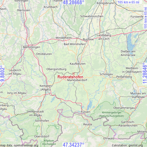
Ruderatshofen GPS coordinates[2]
47° 49' 0.012" North, 10° 34' 59.988" East
| Map corner | latitude | longitude |
|---|---|---|
| Upper-left | 48.28668°, | 9.8802° |
| Center: | 47.81667°, | 10.58333° |
| Lower-right: | 47.34237°, | 11.28646° |
| Map W x H: | 105×105 km | = 65.2×65.2mi |
| max Lat: | 55.01917° ⇑97.5% North |
| Ruderatshofen: | 47.81667° |
| min Lat: | ⇓2.5% South 47.40724° |
| min Long | Ruderatshofen | max Long |
| 5.92978° | 10.58333° | 14.98853° |
| W 60.4%⇐ | ⇒39.6% E |
Elevation
Elevation of Ruderatshofen is 742 m = 2434 ft, and this is 492.9 m = 1617 ft above average elevation for this country.
| Max E: |
1256 m = 4121 ft | 1.4% |
| Ruderatshofen | 742 m 2434 ft | |
| Avg. | 249.1 m = 817 ft | |
Min E: |
-5 m = -16 ft | 98.6% |
See also: Germany elevation on elevation.city.
Geographical zone
Ruderatshofen is located in North temperate zone (between Tropic of Cancer and the Arctic Circle). Distance of this North polar circle is 2084.5 km =1295.2 mi to North.| Distance of | km | miles | from Ruderatshofen |
|---|---|---|---|
| North Pole | 4690.3 | 2914.4 | to North |
| Arctic Circle | 2084.5 | 1295.2 | to North |
| Tropic Cancer | 2710.8 | 1684.4 | to South |
| Equator | 5316.7 | 3303.6 | to South |


Nearby cities:
15 places around Ruderatshofen: (largest is in red/bold)
• Aitrang
3.7 km =2.3 mi,  270°
270°
• Bidingen
10.8 km =6.7 mi,  82°
82°
• Biessenhofen
4.5 km =2.8 mi,  70°
70°
• Eggenthal
12.2 km =7.6 mi,  335°
335°
• Friesenried
7.4 km =4.6 mi,  330°
330°
• Günzach
11.1 km =6.9 mi, 274°
• Irsee
10.2 km =6.3 mi,  355°
355°
• Kaufbeuren
7.9 km =4.9 mi,  21°
21°
• Kraftisried
9.4 km =5.8 mi,  243°
243°
• Marktoberdorf
4.8 km =3 mi,  148°
148°
• Mauerstetten
10.8 km =6.7 mi,  37°
37°
• Stötten am Auerberg
11.7 km =7.3 mi,  137°
137°
• Stöttwang
12.4 km =7.7 mi,  53°
53°
• Unterthingau
7.7 km =4.8 mi,  229°
229°
• Wald
10.6 km =6.6 mi,  190°
190°
Sources, notices
• [Note1] Compared only with cities in Germany existing in our database
• [Src1] Map data: © OpenStreetMap contributors (CC-BY-SA)
• [Src2] Other city data from geonames.org with taken over terms of usage.
• [Src3] Geographical zone / Annual Mean Temperature by Robert A. Rohde @ Wikipedia
