Ungerhausen geodata
Ungerhausen (Bavaria) is a seat of a fourth-order administrative division; located in Germany in Europe/Berlin (GMT+2) time zone. With population of 1,056 people, there are 6978 cities with bigger population in this country. Compared to other cities in Germany, 95.5% of cities are located further ↑North; 54.7% of cities are located further ←West and 95.8% of cities have lower elevation than Ungerhausen. Note1
Administrative division(s):
- Level 1: Bavaria
- Level 2: Swabia
- Level 3: Landkreis Unterallgäu
- Level 4: Ungerhausen


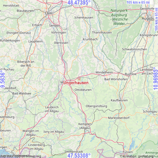
Ungerhausen GPS coordinates[2]
48° 0' 20.376" North, 10° 16' 0.192" East
| Map corner | latitude | longitude |
|---|---|---|
| Upper-left | 48.47395°, | 9.5636° |
| Center: | 48.00566°, | 10.26672° |
| Lower-right: | 47.53308°, | 10.96985° |
| Map W x H: | 104.6×104.6 km | = 65×65mi |
| max Lat: | 55.01917° ⇑95.5% North |
| Ungerhausen: | 48.00566° |
| min Lat: | ⇓4.5% South 47.40724° |
| min Long | Ungerhausen | max Long |
| 5.92978° | 10.26672° | 14.98853° |
| W 54.7%⇐ | ⇒45.3% E |
Elevation
Elevation of Ungerhausen is 619 m = 2031 ft, and this is 369.9 m = 1214 ft above average elevation for this country.
| Max E: |
1256 m = 4121 ft | 4.2% |
| Ungerhausen | 619 m 2031 ft | |
| Avg. | 249.1 m = 817 ft | |
Min E: |
-5 m = -16 ft | 95.8% |
See also: Germany elevation on elevation.city.
Geographical zone
Ungerhausen is located in North temperate zone (between Tropic of Cancer and the Arctic Circle). Distance of this North polar circle is 2063.4 km =1282.1 mi to North.| Distance of | km | miles | from Ungerhausen |
|---|---|---|---|
| North Pole | 4669.3 | 2901.4 | to North |
| Arctic Circle | 2063.4 | 1282.1 | to North |
| Tropic Cancer | 2731.8 | 1697.5 | to South |
| Equator | 5337.7 | 3316.7 | to South |


Nearby cities:
15 places around Ungerhausen: (largest is in red/bold)
• Amendingen
6.5 km =4 mi,  267°
267°
• Benningen
5.7 km =3.5 mi,  220°
220°
• Eisenburg
4.4 km =2.7 mi,  282°
282°
• Erkheim
6.2 km =3.9 mi,  55°
55°
• Hawangen
4.3 km =2.7 mi,  180°
180°
• Holzgünz
2.2 km =1.4 mi,  345°
345°
• Lachen
6.9 km =4.3 mi,  196°
196°
• Lauben
6.2 km =3.9 mi,  16°
16°
• Memmingen
6.5 km =4 mi,  248°
248°
• Memmingerberg
3.8 km =2.4 mi,  238°
238°
• Ottobeuren
7.6 km =4.7 mi,  161°
161°
• Sontheim
6.5 km =4 mi,  88°
88°
• Trunkelsberg
3.8 km =2.4 mi,  260°
260°
• Wald
4.5 km =2.8 mi,  145°
145°
• Westerheim
2.8 km =1.7 mi, 63°
Sources, notices
• [Note1] Compared only with cities in Germany existing in our database
• [Src1] Map data: © OpenStreetMap contributors (CC-BY-SA)
• [Src2] Other city data from geonames.org with taken over terms of usage.
• [Src3] Geographical zone / Annual Mean Temperature by Robert A. Rohde @ Wikipedia
