Ottobeuren geodata
Ottobeuren (Bavaria) is a populated place; located in Germany in Europe/Berlin (GMT+2) time zone. With population of 8,095 people, there are 1941 cities with bigger population in this country. Compared to other cities in Germany, 96.1% of cities are located further ↑North; 55.3% of cities are located further ←West and 96.8% of cities have lower elevation than Ottobeuren. Note1
Administrative division(s):
- Level 1: Bavaria
- Level 2: Swabia
- Level 3: Landkreis Unterallgäu
- Level 4: Ottobeuren, Markt


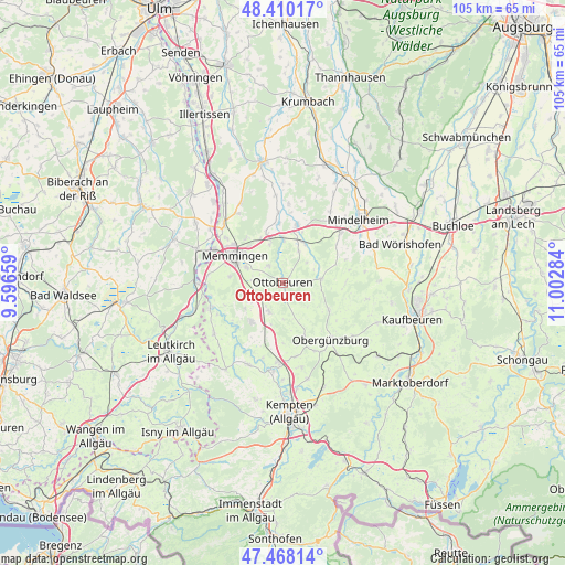
Ottobeuren GPS coordinates[2]
47° 56' 28.68" North, 10° 17' 58.956" East
| Map corner | latitude | longitude |
|---|---|---|
| Upper-left | 48.41017°, | 9.59659° |
| Center: | 47.9413°, | 10.29971° |
| Lower-right: | 47.46814°, | 11.00284° |
| Map W x H: | 104.7×104.7 km | = 65.1×65.1mi |
| max Lat: | 55.01917° ⇑96.1% North |
| Ottobeuren: | 47.9413° |
| min Lat: | ⇓3.9% South 47.40724° |
| min Long | Ottobeuren | max Long |
| 5.92978° | 10.29971° | 14.98853° |
| W 55.3%⇐ | ⇒44.7% E |
Elevation
Elevation of Ottobeuren is 655 m = 2149 ft, and this is 405.9 m = 1332 ft above average elevation for this country.
| Max E: |
1256 m = 4121 ft | 3.2% |
| Ottobeuren | 655 m 2149 ft | |
| Avg. | 249.1 m = 817 ft | |
Min E: |
-5 m = -16 ft | 96.8% |
See also: Germany elevation on elevation.city.
Geographical zone
Ottobeuren is located in North temperate zone (between Tropic of Cancer and the Arctic Circle). Distance of this North polar circle is 2070.6 km =1286.6 mi to North.| Distance of | km | miles | from Ottobeuren |
|---|---|---|---|
| North Pole | 4676.5 | 2905.8 | to North |
| Arctic Circle | 2070.6 | 1286.6 | to North |
| Tropic Cancer | 2724.7 | 1693 | to South |
| Equator | 5330.6 | 3312.3 | to South |


Nearby cities:
15 places around Ottobeuren: (largest is in red/bold)
• Benningen
6.8 km =4.2 mi,  294°
294°
• Böhen
6.4 km =4 mi,  179°
179°
• Dickenreishausen
9.7 km =6 mi,  277°
277°
• Hawangen
3.7 km =2.3 mi,  318°
318°
• Lachen
4.5 km =2.8 mi, 276°
• Markt Rettenbach
7.2 km =4.5 mi,  84°
84°
• Memmingen
9.7 km =6 mi,  298°
298°
• Memmingerberg
7.7 km =4.8 mi,  312°
312°
• Sontheim
8.4 km =5.2 mi,  29°
29°
• Trunkelsberg
9 km =5.6 mi, 316°
• Ungerhausen
7.6 km =4.7 mi,  341°
341°
• Wald
3.4 km =2.1 mi,  1°
1°
• Westerheim
8.4 km =5.2 mi, 0°
• Wolfertschwenden
5.8 km =3.6 mi,  204°
204°
• Woringen
7.9 km =4.9 mi,  249°
249°
Sources, notices
• [Note1] Compared only with cities in Germany existing in our database
• [Src1] Map data: © OpenStreetMap contributors (CC-BY-SA)
• [Src2] Other city data from geonames.org with taken over terms of usage.
• [Src3] Geographical zone / Annual Mean Temperature by Robert A. Rohde @ Wikipedia
