Thallichtenberg geodata
Thallichtenberg (Rheinland-Pfalz) is a seat of a fourth-order administrative division; located in Germany in Europe/Berlin (GMT+2) time zone. With population of 593 people, there are 8865 cities with bigger population in this country. Compared to other cities in Germany, 74.6% of cities are located further ↑North; 89.1% of cities are located further →East and 62.7% of cities have lower elevation than Thallichtenberg. Note1
Administrative division(s):
- Level 1: Rheinland-Pfalz
- Level 3: Landkreis Kusel
- Level 4: Thallichtenberg


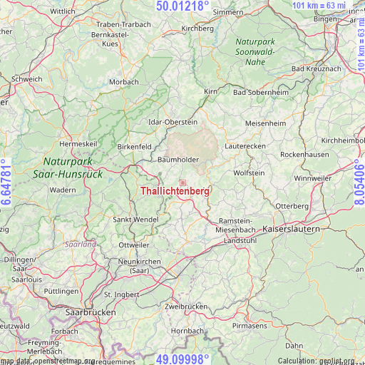
Thallichtenberg GPS coordinates[2]
49° 33' 29.556" North, 7° 21' 3.348" East
| Map corner | latitude | longitude |
|---|---|---|
| Upper-left | 50.01218°, | 6.64781° |
| Center: | 49.55821°, | 7.35093° |
| Lower-right: | 49.09998°, | 8.05406° |
| Map W x H: | 101.4×101.4 km | = 63×63mi |
| max Lat: | 55.01917° ⇑74.6% North |
| Thallichtenberg: | 49.55821° |
| min Lat: | ⇓25.4% South 47.40724° |
| min Long | Thallichtenberg | max Long |
| 5.92978° | 7.35093° | 14.98853° |
| W 10.9%⇐ | ⇒89.1% E |
Elevation
Elevation of Thallichtenberg is 306 m = 1004 ft, and this is 56.9 m = 187 ft above average elevation for this country.
| Max E: |
1256 m = 4121 ft | 37.3% |
| Thallichtenberg | 306 m 1004 ft | |
| Avg. | 249.1 m = 817 ft | |
Min E: |
-5 m = -16 ft | 62.7% |
See also: Germany elevation on elevation.city.
Geographical zone
Thallichtenberg is located in North temperate zone (between Tropic of Cancer and the Arctic Circle). Distance of this North polar circle is 1890.8 km =1174.9 mi to North.| Distance of | km | miles | from Thallichtenberg |
|---|---|---|---|
| North Pole | 4496.7 | 2794.1 | to North |
| Arctic Circle | 1890.8 | 1174.9 | to North |
| Tropic Cancer | 2904.4 | 1804.7 | to South |
| Equator | 5510.4 | 3424 | to South |


Nearby cities:
15 places around Thallichtenberg: (largest is in red/bold)
• Albessen
4.8 km =3 mi,  195°
195°
• Blaubach
3.7 km =2.3 mi,  75°
75°
• Dennweiler-Frohnbach
3.6 km =2.2 mi,  39°
39°
• Eckersweiler
5 km =3.1 mi,  280°
280°
• Ehweiler
4.8 km =3 mi,  166°
166°
• Fohren-Linden
5.6 km =3.5 mi,  299°
299°
• Konken
5.5 km =3.4 mi,  177°
177°
• Kusel
4.5 km =2.8 mi,  120°
120°
• Körborn
1.5 km =0.9 mi,  50°
50°
• Mettweiler
3.7 km =2.3 mi,  318°
318°
• Oberalben
4.5 km =2.8 mi, 51°
• Pfeffelbach
2.7 km =1.7 mi,  218°
218°
• Reichweiler
5.6 km =3.5 mi,  240°
240°
• Ruthweiler
1.5 km =0.9 mi,  128°
128°
• Schellweiler
5.7 km =3.5 mi,  149°
149°
Sources, notices
• [Note1] Compared only with cities in Germany existing in our database
• [Src1] Map data: © OpenStreetMap contributors (CC-BY-SA)
• [Src2] Other city data from geonames.org with taken over terms of usage.
• [Src3] Geographical zone / Annual Mean Temperature by Robert A. Rohde @ Wikipedia
