Schellweiler geodata
Schellweiler (Rheinland-Pfalz) is a seat of a fourth-order administrative division; located in Germany in Europe/Berlin (GMT+2) time zone. With population of 538 people, there are 9146 cities with bigger population in this country. Compared to other cities in Germany, 75.5% of cities are located further ↑North; 88.7% of cities are located further →East and 60.2% of cities have lower elevation than Schellweiler. Note1


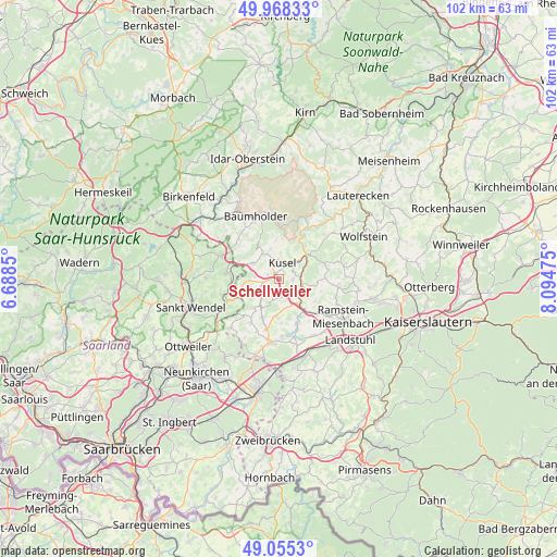
Schellweiler GPS coordinates[2]
49° 30' 50.22" North, 7° 23' 29.868" East
| Map corner | latitude | longitude |
|---|---|---|
| Upper-left | 49.96833°, | 6.6885° |
| Center: | 49.51395°, | 7.39163° |
| Lower-right: | 49.0553°, | 8.09475° |
| Map W x H: | 101.5×101.5 km | = 63.1×63.1mi |
| max Lat: | 55.01917° ⇑75.5% North |
| Schellweiler: | 49.51395° |
| min Lat: | ⇓24.5% South 47.40724° |
| min Long | Schellweiler | max Long |
| 5.92978° | 7.39163° | 14.98853° |
| W 11.3%⇐ | ⇒88.7% E |
Elevation
Elevation of Schellweiler is 291 m = 955 ft, and this is 41.9 m = 137 ft above average elevation for this country.
| Max E: |
1256 m = 4121 ft | 39.8% |
| Schellweiler | 291 m 955 ft | |
| Avg. | 249.1 m = 817 ft | |
Min E: |
-5 m = -16 ft | 60.2% |
See also: Germany elevation on elevation.city.
Geographical zone
Schellweiler is located in North temperate zone (between Tropic of Cancer and the Arctic Circle). Distance of this North polar circle is 1895.7 km =1177.9 mi to North.| Distance of | km | miles | from Schellweiler |
|---|---|---|---|
| North Pole | 4501.6 | 2797.2 | to North |
| Arctic Circle | 1895.7 | 1177.9 | to North |
| Tropic Cancer | 2899.5 | 1801.7 | to South |
| Equator | 5505.4 | 3420.9 | to South |


Nearby cities:
15 places around Schellweiler: (largest is in red/bold)
• Albessen
4.2 km =2.6 mi,  274°
274°
• Ehweiler
1.8 km =1.1 mi,  279°
279°
• Etschberg
3 km =1.9 mi,  84°
84°
• Haschbach am Remigiusberg
3.7 km =2.3 mi,  54°
54°
• Herschweiler-Pettersheim
4.5 km =2.8 mi,  221°
221°
• Hüffler
1.7 km =1.1 mi,  201°
201°
• Konken
2.8 km =1.7 mi,  258°
258°
• Kusel
2.8 km =1.7 mi,  19°
19°
• Langenbach
5.1 km =3.2 mi,  243°
243°
• Quirnbach
4.8 km =3 mi,  154°
154°
• Rammelsbach
4.9 km =3 mi, 50°
• Rehweiler
4.8 km =3 mi,  130°
130°
• Ruthweiler
4.4 km =2.7 mi,  335°
335°
• Theisbergstegen
4.1 km =2.5 mi, 84°
• Wahnwegen
3.4 km =2.1 mi, 198°
Sources, notices
• [Note1] Compared only with cities in Germany existing in our database
• [Src1] Map data: © OpenStreetMap contributors (CC-BY-SA)
• [Src2] Other city data from geonames.org with taken over terms of usage.
• [Src3] Geographical zone / Annual Mean Temperature by Robert A. Rohde @ Wikipedia
